Mizantecatl geodata
Mizantecatl (Veracruz) is a populated place; located in Mexico in America/Mexico_City (GMT-6) time zone. With population of 643 people, there are 13457 cities with bigger population in this country. Compared to other cities in Mexico, 64.1% of cities are located further ↓South; 71.3% of cities are located further ←West and 83.4% of cities have higher elevation than Mizantecatl. Note1


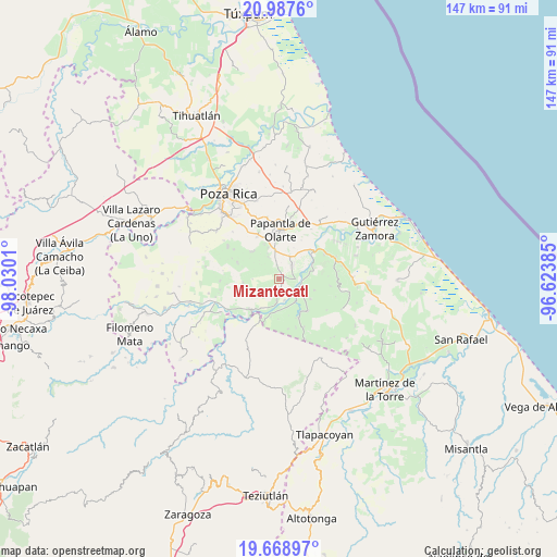
Mizantecatl GPS coordinates[2]
20° 19' 46.884" North, 97° 19' 37.092" West
| Map corner | latitude | longitude |
|---|---|---|
| Upper-left | 20.9876°, | -98.0301° |
| Center: | 20.32969°, | -97.32697° |
| Lower-right: | 19.66897°, | -96.62385° |
| Map W x H: | 146.6×146.6 km | = 91.1×91.1mi |
| max Lat: | 32.7° ⇑35.9% North |
| Mizantecatl: | 20.32969° |
| min Lat: | ⇓64.1% South 14.53588° |
| min Long | Mizantecatl | max Long |
| -117.105° | -97.32697° | -86.73105° |
| W 71.3%⇐ | ⇒28.7% E |
Elevation
Elevation of Mizantecatl is 57 m = 187 ft, and this is 1196.7 m = 3926 ft below average elevation for this country.
| Max E: |
3497 m = 11473 ft | 83.4% |
| Avg. | 1253.7 m = 4113 ft | |
| Mizantecatl | 57 m = 187 ft | |
Min E: |
-1 m = -3 ft | 16.6% |
See also: Mexico elevation on elevation.city.
Geographical zone
Mizantecatl is located in North Torrid zone (between Equator and Tropic of Cancer). Distance of this Northern Tropic circle is 345.5 km =214.7 mi to North.| Distance of | km | miles | from Mizantecatl |
|---|---|---|---|
| North Pole | 7746.6 | 4813.5 | to North |
| Arctic Circle | 5140.7 | 3194.3 | to North |
| Tropic Cancer | 345.5 | 214.7 | to North |
| Equator | 2260.4 | 1404.5 | to South |


Nearby cities:
15 places around Mizantecatl: (largest is in red/bold)
• Agua Dulce
5.1 km =3.2 mi,  43°
43°
• Arroyo del Arco
3.5 km =2.2 mi,  339°
339°
• Cerro del Carbón
9.2 km =5.7 mi,  25°
25°
• El Cedral
8.6 km =5.3 mi,  185°
185°
• El Chote
8.2 km =5.1 mi,  347°
347°
• El Porvenir Número Uno
7.3 km =4.5 mi,  24°
24°
• Francisco Villa
3.8 km =2.4 mi, 352°
• Guadalupe Victoria
8.9 km =5.5 mi,  212°
212°
• José María Morelos
9.4 km =5.8 mi,  264°
264°
• La Isla
8.2 km =5.1 mi,  78°
78°
• Pajasco Limonar
8 km =5 mi,  201°
201°
• Paso de Valencia
6.5 km =4 mi, 186°
• Paso del Correo
5.9 km =3.7 mi,  104°
104°
• San Lorenzo
1 km =0.6 mi,  50°
50°
• Serafín Olarte
4.9 km =3 mi, 351°
Sources, notices
• [Note1] Compared only with cities in Mexico existing in our database
• [Src1] Map data: © OpenStreetMap contributors (CC-BY-SA)
• [Src2] Other city data from geonames.org with taken over terms of usage.
• [Src3] Geographical zone / Annual Mean Temperature by Robert A. Rohde @ Wikipedia
