La Pimienta geodata
La Pimienta (Veracruz) is a populated place; located in Mexico in America/Mexico_City (GMT-6) time zone. With population of 639 people, there are 13559 cities with bigger population in this country. Compared to other cities in Mexico, 80.5% of cities are located further ↓South; 68.3% of cities are located further ←West and 83.5% of cities have higher elevation than La Pimienta. Note1


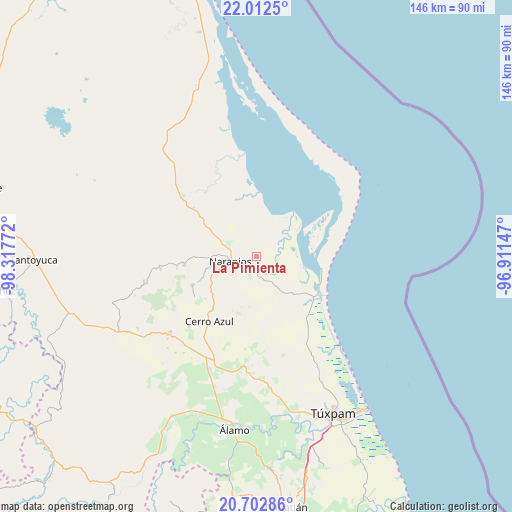
La Pimienta GPS coordinates[2]
21° 21' 32.904" North, 97° 36' 52.524" West
| Map corner | latitude | longitude |
|---|---|---|
| Upper-left | 22.0125°, | -98.31772° |
| Center: | 21.35914°, | -97.61459° |
| Lower-right: | 20.70286°, | -96.91147° |
| Map W x H: | 145.6×145.6 km | = 90.5×90.5mi |
| max Lat: | 32.7° ⇑19.5% North |
| La Pimienta: | 21.35914° |
| min Lat: | ⇓80.5% South 14.53588° |
| min Long | La Pimienta | max Long |
| -117.105° | -97.61459° | -86.73105° |
| W 68.3%⇐ | ⇒31.7% E |
Elevation
Elevation of La Pimienta is 55 m = 180 ft, and this is 1198.7 m = 3933 ft below average elevation for this country.
| Max E: |
3497 m = 11473 ft | 83.5% |
| Avg. | 1253.7 m = 4113 ft | |
| La Pimienta | 55 m = 180 ft | |
Min E: |
-1 m = -3 ft | 16.5% |
See also: Mexico elevation on elevation.city.
Geographical zone
La Pimienta is located in North Torrid zone (between Equator and Tropic of Cancer). Distance of this Northern Tropic circle is 231 km =143.5 mi to North.| Distance of | km | miles | from La Pimienta |
|---|---|---|---|
| North Pole | 7632.1 | 4742.4 | to North |
| Arctic Circle | 5026.3 | 3123.2 | to North |
| Tropic Cancer | 231 | 143.5 | to North |
| Equator | 2374.9 | 1475.7 | to South |


Nearby cities:
15 places around La Pimienta: (largest is in red/bold)
• Amatlán
15 km =9.3 mi,  259°
259°
• Carmona y Valle
18.7 km =11.6 mi,  270°
270°
• Cervantes
10.1 km =6.3 mi,  254°
254°
• Chinampa de Gorostiza
12.5 km =7.8 mi, 270°
• Colonia las Flores
8.1 km =5 mi, 271°
• El Anono
12.3 km =7.6 mi,  200°
200°
• El Cafetal
18.4 km =11.4 mi,  193°
193°
• Galeana
10.9 km =6.8 mi,  226°
226°
• Gutiérrez Zamora
19.1 km =11.9 mi, 272°
• La Reforma
10.3 km =6.4 mi,  49°
49°
• Mamey la Mar
18.1 km =11.2 mi,  349°
349°
• Naranjos
7.5 km =4.7 mi, 262°
• Rancho Nuevo
6.5 km =4 mi, 246°
• Saladero
10.3 km =6.4 mi, 45°
• Zacamixtle
16.6 km =10.3 mi,  221°
221°
Sources, notices
• [Note1] Compared only with cities in Mexico existing in our database
• [Src1] Map data: © OpenStreetMap contributors (CC-BY-SA)
• [Src2] Other city data from geonames.org with taken over terms of usage.
• [Src3] Geographical zone / Annual Mean Temperature by Robert A. Rohde @ Wikipedia
