Galeana geodata
Galeana (Veracruz) is a populated place; located in Mexico in America/Mexico_City (GMT-6) time zone. With population of 625 people, there are 13838 cities with bigger population in this country. Compared to other cities in Mexico, 80% of cities are located further ↓South; 67.4% of cities are located further ←West and 77.7% of cities have higher elevation than Galeana. Note1


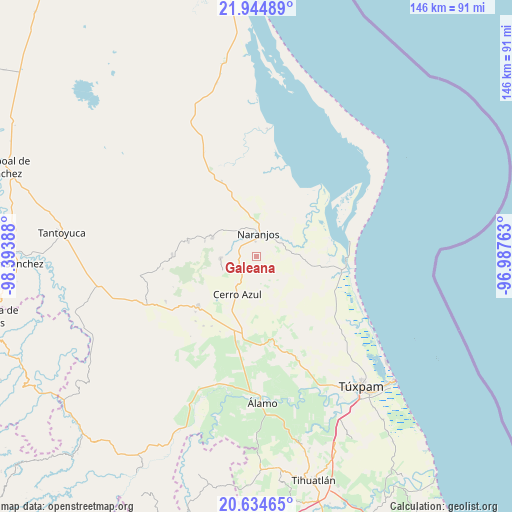
Galeana GPS coordinates[2]
21° 17' 28.428" North, 97° 41' 26.7" West
| Map corner | latitude | longitude |
|---|---|---|
| Upper-left | 21.94489°, | -98.39388° |
| Center: | 21.29123°, | -97.69075° |
| Lower-right: | 20.63465°, | -96.98763° |
| Map W x H: | 145.7×145.7 km | = 90.5×90.5mi |
| max Lat: | 32.7° ⇑20% North |
| Galeana: | 21.29123° |
| min Lat: | ⇓80% South 14.53588° |
| min Long | Galeana | max Long |
| -117.105° | -97.69075° | -86.73105° |
| W 67.4%⇐ | ⇒32.6% E |
Elevation
Elevation of Galeana is 138 m = 453 ft, and this is 1115.7 m = 3660 ft below average elevation for this country.
| Max E: |
3497 m = 11473 ft | 77.7% |
| Avg. | 1253.7 m = 4113 ft | |
| Galeana | 138 m = 453 ft | |
Min E: |
-1 m = -3 ft | 22.3% |
See also: Mexico elevation on elevation.city.
Geographical zone
Galeana is located in North Torrid zone (between Equator and Tropic of Cancer). Distance of this Northern Tropic circle is 238.6 km =148.3 mi to North.| Distance of | km | miles | from Galeana |
|---|---|---|---|
| North Pole | 7639.7 | 4747.1 | to North |
| Arctic Circle | 5033.8 | 3127.9 | to North |
| Tropic Cancer | 238.6 | 148.3 | to North |
| Equator | 2367.4 | 1471 | to South |


Nearby cities:
15 places around Galeana: (largest is in red/bold)
• Amatlán
8.4 km =5.2 mi,  305°
305°
• Carmona y Valle
13.3 km =8.3 mi, 305°
• Cerro Azul
12.2 km =7.6 mi,  205°
205°
• Cervantes
5.1 km =3.2 mi,  339°
339°
• Chinampa de Gorostiza
8.9 km =5.5 mi,  329°
329°
• Colonia las Flores
7.8 km =4.8 mi,  358°
358°
• El Anono
5.3 km =3.3 mi,  138°
138°
• El Cafetal
11 km =6.8 mi,  160°
160°
• Gutiérrez Zamora
14 km =8.7 mi, 307°
• La Pimienta
10.9 km =6.8 mi,  46°
46°
• Naranjos
6.6 km =4.1 mi,  3°
3°
• Rancho Nuevo
5.3 km =3.3 mi,  21°
21°
• Tamalín
13.6 km =8.5 mi,  293°
293°
• Tancoco
10.4 km =6.5 mi,  266°
266°
• Zacamixtle
5.8 km =3.6 mi, 213°
Sources, notices
• [Note1] Compared only with cities in Mexico existing in our database
• [Src1] Map data: © OpenStreetMap contributors (CC-BY-SA)
• [Src2] Other city data from geonames.org with taken over terms of usage.
• [Src3] Geographical zone / Annual Mean Temperature by Robert A. Rohde @ Wikipedia
