Licenciado Benito Juárez (Campo Gobierno) geodata
Licenciado Benito Juárez (Campo Gobierno) (Sinaloa) is a populated place; located in Mexico in America/Mazatlan (GMT-7) time zone. With population of 24,185 people, there are 421 cities with bigger population in this country. Compared to other cities in Mexico, 91.1% of cities are located further ↓South; 95% of cities are located further →East and 96.3% of cities have higher elevation than Licenciado Benito Juárez (Campo Gobierno). Note1
Current local time in Licenciado Benito Juárez (Campo Gobierno):
06:20 AM, MondayDifference from your time zone: hours


Licenciado Benito Juárez (Campo Gobierno) GPS coordinates[2]
24° 39' 24.012" North, 107° 32' 42" West
| Map corner | latitude | longitude |
|---|---|---|
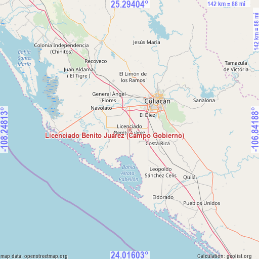
| Upper-left | 25.29404°, | -108.24813° |
| Center: | 24.65667°, | -107.545° |
| Lower-right: | 24.01603°, | -106.84188° |
| Map W x H: | 142.1×142.1 km | = 88.3×88.3mi |
| max Lat: | 32.7° ⇑8.9% North |
| Licenciado Benito Juárez (Campo Gobierno): | 24.65667° |
| min Lat: | ⇓91.1% South 14.53588° |
| min Long | Licenciado Beni | max Long |
| -117.105° | -107.545° | -86.73105° |
| W 5%⇐ | ⇒95% E |
Elevation
Elevation of Licenciado Benito Juárez (Campo Gobierno) is 11 m = 36 ft, and this is 1242.7 m = 4077 ft below average elevation for this country.
| Max E: |
3497 m = 11473 ft | 96.3% |
| Avg. | 1253.7 m = 4113 ft | |
| Licenciado Benito Juárez (Campo Gobierno) | 11 m = 36 ft | |
Min E: |
-1 m = -3 ft | 3.7% |
See also: Mexico elevation on elevation.city.
Geographical zone
Licenciado Benito Juárez (Campo Gobierno) is located in North temperate zone (between Tropic of Cancer and the Arctic Circle). Distance of this Northern Tropic circle is 135.6 km =84.3 mi to South.| Distance of | km | miles | from Licenciado Benito Juárez (Campo Gobierno) |
|---|---|---|---|
| North Pole | 7265.5 | 4514.6 | to North |
| Arctic Circle | 4659.6 | 2895.3 | to North |
| Tropic Cancer | 135.6 | 84.3 | to South |
| Equator | 2741.6 | 1703.6 | to South |


Nearby cities:
15 places around Licenciado Benito Juárez (Campo Gobierno): (largest is in red/bold)
• Argentina Dos
13.5 km =8.4 mi,  60°
60°
• Bachigualatito
9.9 km =6.2 mi,  50°
50°
• Batallón
12.9 km =8 mi,  339°
339°
• Campo Balbuena
10 km =6.2 mi,  357°
357°
• Colonia Michoacana
11.6 km =7.2 mi,  310°
310°
• Colonia Michoacana (Luis Vélez)
6.7 km =4.2 mi,  278°
278°
• Ejido el Quemadito
13.9 km =8.6 mi,  70°
70°
• El Diez
12 km =7.5 mi, 51°
• Iraguato
12.7 km =7.9 mi,  253°
253°
• La Curva (La Curva de San Pedro)
9.3 km =5.8 mi,  326°
326°
• Las Puentes (Guadalupe Victoria)
13.8 km =8.6 mi,  178°
178°
• Lo de Jesús (Campo Romero)
2.6 km =1.6 mi, 358°
• Sataya
11.7 km =7.3 mi, 254°
• Villa Juárez
0.5 km =0.3 mi, 63°
• Villamoros
12.8 km =8 mi,  274°
274°
Sources, notices
• [Note1] Compared only with cities in Mexico existing in our database
• [Src1] Map data: © OpenStreetMap contributors (CC-BY-SA)
• [Src2] Other city data from geonames.org with taken over terms of usage.
• [Src3] Geographical zone / Annual Mean Temperature by Robert A. Rohde @ Wikipedia
