Los Ruiseñores geodata
Los Ruiseñores (Jalisco) is a populated place; located in Mexico in America/Mexico_City (GMT-6) time zone. With population of 7,493 people, there are 1246 cities with bigger population in this country. Compared to other cities in Mexico, 71.9% of cities are located further ↓South; 89% of cities are located further →East and 50.7% of cities have higher elevation than Los Ruiseñores. Note1


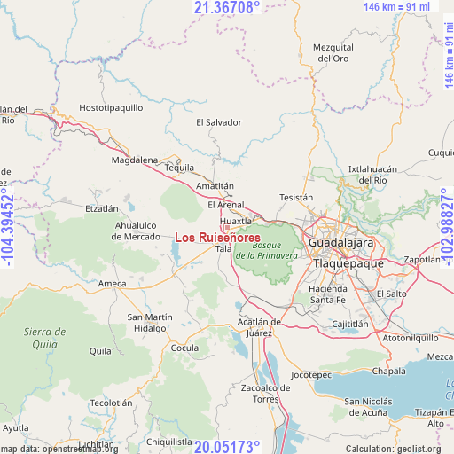
Los Ruiseñores GPS coordinates[2]
20° 42' 38.988" North, 103° 41' 29.004" West
| Map corner | latitude | longitude |
|---|---|---|
| Upper-left | 21.36708°, | -104.39452° |
| Center: | 20.71083°, | -103.69139° |
| Lower-right: | 20.05173°, | -102.98827° |
| Map W x H: | 146.3×146.3 km | = 90.9×90.9mi |
| max Lat: | 32.7° ⇑28.1% North |
| Los Ruiseñores: | 20.71083° |
| min Lat: | ⇓71.9% South 14.53588° |
| min Long | Los Ruiseñores | max Long |
| -117.105° | -103.69139° | -86.73105° |
| W 11%⇐ | ⇒89% E |
Elevation
Elevation of Los Ruiseñores is 1396 m = 4580 ft, and this is 142.3 m = 467 ft above average elevation for this country.
| Max E: |
3497 m = 11473 ft | 50.7% |
| Los Ruiseñores | 1396 m 4580 ft | |
| Avg. | 1253.7 m = 4113 ft | |
Min E: |
-1 m = -3 ft | 49.3% |
See also: Mexico elevation on elevation.city.
Geographical zone
Los Ruiseñores is located in North Torrid zone (between Equator and Tropic of Cancer). Distance of this Northern Tropic circle is 303.1 km =188.3 mi to North.| Distance of | km | miles | from Los Ruiseñores |
|---|---|---|---|
| North Pole | 7704.2 | 4787.2 | to North |
| Arctic Circle | 5098.3 | 3167.9 | to North |
| Tropic Cancer | 303.1 | 188.3 | to North |
| Equator | 2302.8 | 1430.9 | to South |


Nearby cities:
15 places around Los Ruiseñores: (largest is in red/bold)
• Ahuisculco
15.8 km =9.8 mi,  184°
184°
• Amatitán
14.3 km =8.9 mi,  343°
343°
• Colonia Cuisillos (Huaxtla de Orendain)
4 km =2.5 mi,  68°
68°
• Cuisillos
14.2 km =8.8 mi,  217°
217°
• El Arenal
7.2 km =4.5 mi,  358°
358°
• El Ranchito (San Isidro)
15.5 km =9.6 mi, 218°
• El Refugio
6.6 km =4.1 mi,  228°
228°
• Huaxtla
3.8 km =2.4 mi,  51°
51°
• La Estanzuela
14.8 km =9.2 mi,  251°
251°
• La Primavera
13.2 km =8.2 mi,  84°
84°
• La Venta del Astillero
15.3 km =9.5 mi, 82°
• San Juan de los Arcos
12.1 km =7.5 mi,  193°
193°
• Santa Cruz del Astillero
6.4 km =4 mi, 51°
• Santiaguito
8.4 km =5.2 mi, 336°
• Tala
6.4 km =4 mi, 188°
Sources, notices
• [Note1] Compared only with cities in Mexico existing in our database
• [Src1] Map data: © OpenStreetMap contributors (CC-BY-SA)
• [Src2] Other city data from geonames.org with taken over terms of usage.
• [Src3] Geographical zone / Annual Mean Temperature by Robert A. Rohde @ Wikipedia
