Tepetzingo geodata
Tepetzingo (State of Mexico) is a populated place; located in Mexico in America/Mexico_City (GMT-6) time zone. With population of 2,503 people, there are 3528 cities with bigger population in this country. Compared to other cities in Mexico, 66.1% of cities are located further ↑North; 58.8% of cities are located further →East and 78% of cities have lower elevation than Tepetzingo. Note1


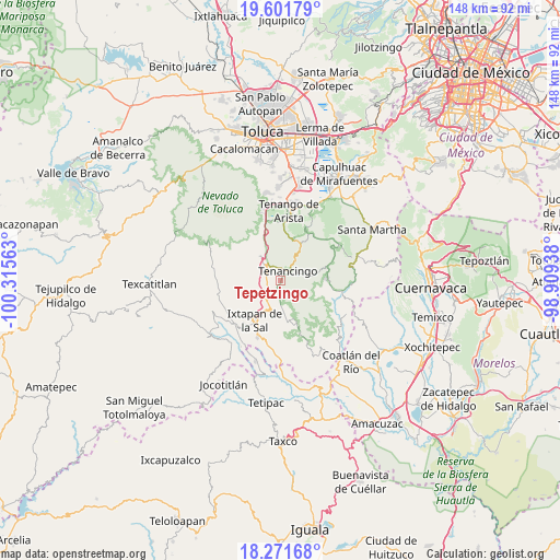
Tepetzingo GPS coordinates[2]
18° 56' 17.016" North, 99° 36' 45" West
| Map corner | latitude | longitude |
|---|---|---|
| Upper-left | 19.60179°, | -100.31563° |
| Center: | 18.93806°, | -99.6125° |
| Lower-right: | 18.27168°, | -98.90938° |
| Map W x H: | 147.9×147.9 km | = 91.9×91.9mi |
| max Lat: | 32.7° ⇑66.1% North |
| Tepetzingo: | 18.93806° |
| min Lat: | ⇓33.9% South 14.53588° |
| min Long | Tepetzingo | max Long |
| -117.105° | -99.6125° | -86.73105° |
| W 41.2%⇐ | ⇒58.8% E |
Elevation
Elevation of Tepetzingo is 2089 m = 6854 ft, and this is 835.3 m = 2740 ft above average elevation for this country.
| Max E: |
3497 m = 11473 ft | 22% |
| Tepetzingo | 2089 m 6854 ft | |
| Avg. | 1253.7 m = 4113 ft | |
Min E: |
-1 m = -3 ft | 78% |
See also: Mexico elevation on elevation.city.
Geographical zone
Tepetzingo is located in North Torrid zone (between Equator and Tropic of Cancer). Distance of this Northern Tropic circle is 500.2 km =310.8 mi to North.| Distance of | km | miles | from Tepetzingo |
|---|---|---|---|
| North Pole | 7901.3 | 4909.6 | to North |
| Arctic Circle | 5295.5 | 3290.5 | to North |
| Tropic Cancer | 500.2 | 310.8 | to North |
| Equator | 2105.7 | 1308.4 | to South |


Nearby cities:
15 places around Tepetzingo: (largest is in red/bold)
• Acatzingo (Acatzingo de la Piedra)
3 km =1.9 mi,  122°
122°
• Barrio Santa Teresa
3.3 km =2.1 mi,  20°
20°
• Coxcacoaco
2.4 km =1.5 mi,  318°
318°
• Ejido de San Mateo Coapexco
3.4 km =2.1 mi,  290°
290°
• El Salitre
2.9 km =1.8 mi,  56°
56°
• Ixpuichiapan
2.7 km =1.7 mi,  102°
102°
• Jesús Carranza (Rancho de Jesús)
2.1 km =1.3 mi, 292°
• La Ciénega
3.8 km =2.4 mi, 58°
• La Lagunilla
1.3 km =0.8 mi,  202°
202°
• Pueblo Nuevo
3.2 km =2 mi,  69°
69°
• Quetzalapa
1.7 km =1.1 mi,  80°
80°
• Santa Ana Ixtlahuatzingo (Santa Ana)
3.8 km =2.4 mi,  342°
342°
• Tenancingo de Degollado
3.5 km =2.2 mi,  42°
42°
• Tepalcatepec
1.4 km =0.9 mi, 101°
• Terrenate
2.3 km =1.4 mi, 120°
Sources, notices
• [Note1] Compared only with cities in Mexico existing in our database
• [Src1] Map data: © OpenStreetMap contributors (CC-BY-SA)
• [Src2] Other city data from geonames.org with taken over terms of usage.
• [Src3] Geographical zone / Annual Mean Temperature by Robert A. Rohde @ Wikipedia
