Jesús Carranza (Rancho de Jesús) geodata
Jesús Carranza (Rancho de Jesús) (State of Mexico) is a populated place; located in Mexico in America/Mexico_City (GMT-6) time zone. With population of 1,382 people, there are 6268 cities with bigger population in this country. Compared to other cities in Mexico, 65.9% of cities are located further ↑North; 59.1% of cities are located further →East and 76.1% of cities have lower elevation than Jesús Carranza (Rancho de Jesús). Note1
Current local time in Jesús Carranza (Rancho de Jesús):
08:29 AM, WednesdayDifference from your time zone: hours


Jesús Carranza (Rancho de Jesús) GPS coordinates[2]
18° 56' 43.008" North, 99° 37' 50.016" West
| Map corner | latitude | longitude |
|---|---|---|
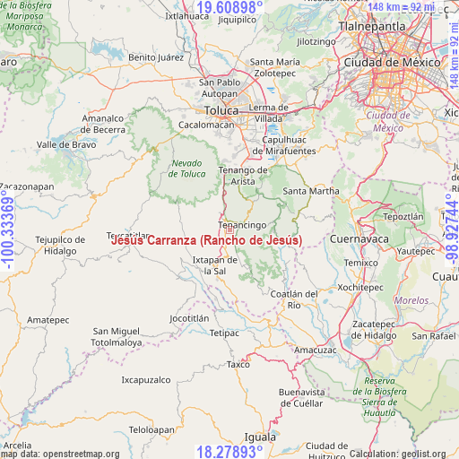
| Upper-left | 19.60898°, | -100.33369° |
| Center: | 18.94528°, | -99.63056° |
| Lower-right: | 18.27893°, | -98.92744° |
| Map W x H: | 147.9×147.9 km | = 91.9×91.9mi |
| max Lat: | 32.7° ⇑65.9% North |
| Jesús Carranza (Rancho de Jesús): | 18.94528° |
| min Lat: | ⇓34.1% South 14.53588° |
| min Long | Jesús Carranza | max Long |
| -117.105° | -99.63056° | -86.73105° |
| W 40.9%⇐ | ⇒59.1% E |
Elevation
Elevation of Jesús Carranza (Rancho de Jesús) is 2050 m = 6726 ft, and this is 796.3 m = 2613 ft above average elevation for this country.
| Max E: |
3497 m = 11473 ft | 23.9% |
| Jesús Carranza (Rancho de Jesús) | 2050 m 6726 ft | |
| Avg. | 1253.7 m = 4113 ft | |
Min E: |
-1 m = -3 ft | 76.1% |
See also: Mexico elevation on elevation.city.
Geographical zone
Jesús Carranza (Rancho de Jesús) is located in North Torrid zone (between Equator and Tropic of Cancer). Distance of this Northern Tropic circle is 499.4 km =310.3 mi to North.| Distance of | km | miles | from Jesús Carranza (Rancho de Jesús) |
|---|---|---|---|
| North Pole | 7900.5 | 4909.1 | to North |
| Arctic Circle | 5294.7 | 3290 | to North |
| Tropic Cancer | 499.4 | 310.3 | to North |
| Equator | 2106.5 | 1308.9 | to South |


Nearby cities:
15 places around Jesús Carranza (Rancho de Jesús): (largest is in red/bold)
• Barrio Santa Teresa
3.8 km =2.4 mi,  53°
53°
• Buenavista
2.8 km =1.7 mi,  270°
270°
• Coxcacoaco
1.1 km =0.7 mi,  14°
14°
• Ejido de San Mateo Coapexco
1.3 km =0.8 mi,  287°
287°
• El Islote
3.9 km =2.4 mi,  310°
310°
• El Salitre
4.4 km =2.7 mi,  79°
79°
• La Joya
3.8 km =2.4 mi,  322°
322°
• La Lagunilla
2.4 km =1.5 mi,  145°
145°
• Quetzalapa
3.6 km =2.2 mi,  98°
98°
• San Felipe
2.9 km =1.8 mi,  241°
241°
• San Francisco
1.8 km =1.1 mi,  284°
284°
• Santa Ana Ixtlahuatzingo (Santa Ana)
2.9 km =1.8 mi, 14°
• Tepalcatepec
3.5 km =2.2 mi,  108°
108°
• Tepetzingo
2.1 km =1.3 mi, 112°
• Villa Guerrero
2.1 km =1.3 mi,  330°
330°
Sources, notices
• [Note1] Compared only with cities in Mexico existing in our database
• [Src1] Map data: © OpenStreetMap contributors (CC-BY-SA)
• [Src2] Other city data from geonames.org with taken over terms of usage.
• [Src3] Geographical zone / Annual Mean Temperature by Robert A. Rohde @ Wikipedia
