San Jerónimo Almoloya geodata
San Jerónimo Almoloya (Puebla) is a populated place; located in Mexico in America/Mexico_City (GMT-6) time zone. With population of 2,482 people, there are 3563 cities with bigger population in this country. Compared to other cities in Mexico, 66% of cities are located further ↑North; 63.5% of cities are located further ←West and 80.5% of cities have lower elevation than San Jerónimo Almoloya. Note1


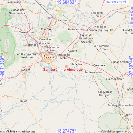
San Jerónimo Almoloya GPS coordinates[2]
18° 56' 27.996" North, 98° 0' 38.016" West
| Map corner | latitude | longitude |
|---|---|---|
| Upper-left | 19.60482°, | -98.71369° |
| Center: | 18.94111°, | -98.01056° |
| Lower-right: | 18.27475°, | -97.30744° |
| Map W x H: | 147.9×147.9 km | = 91.9×91.9mi |
| max Lat: | 32.7° ⇑66% North |
| San Jerónimo Almoloya: | 18.94111° |
| min Lat: | ⇓34% South 14.53588° |
| min Long | San Jerónimo A | max Long |
| -117.105° | -98.01056° | -86.73105° |
| W 63.5%⇐ | ⇒36.5% E |
Elevation
Elevation of San Jerónimo Almoloya is 2153 m = 7064 ft, and this is 899.3 m = 2950 ft above average elevation for this country.
| Max E: |
3497 m = 11473 ft | 19.5% |
| San Jerónimo Almoloya | 2153 m 7064 ft | |
| Avg. | 1253.7 m = 4113 ft | |
Min E: |
-1 m = -3 ft | 80.5% |
See also: Mexico elevation on elevation.city.
Geographical zone
San Jerónimo Almoloya is located in North Torrid zone (between Equator and Tropic of Cancer). Distance of this Northern Tropic circle is 499.9 km =310.6 mi to North.| Distance of | km | miles | from San Jerónimo Almoloya |
|---|---|---|---|
| North Pole | 7901 | 4909.5 | to North |
| Arctic Circle | 5295.1 | 3290.2 | to North |
| Tropic Cancer | 499.9 | 310.6 | to North |
| Equator | 2106.1 | 1308.7 | to South |


Nearby cities:
15 places around San Jerónimo Almoloya: (largest is in red/bold)
• Actipan
11.4 km =7.1 mi,  92°
92°
• Alpatláhuac (San Pedro Alpatláhuac)
3.4 km =2.1 mi,  256°
256°
• Concepción Cuautla
8.7 km =5.4 mi,  161°
161°
• Concepción Pardiñas
4 km =2.5 mi,  58°
58°
• Cuautinchán
1.6 km =1 mi,  340°
340°
• La Magdalena Cuaxixtla
8.8 km =5.5 mi,  141°
141°
• La Trinidad Tianguismanalco
5.7 km =3.5 mi,  203°
203°
• San Buenaventura
9.9 km =6.2 mi,  116°
116°
• San Jerónimo Ocotitla
11.2 km =7 mi,  26°
26°
• San Luis Ajajalpan
8.1 km =5 mi, 93°
• Santa Cruz Ajajalpan
6.5 km =4 mi,  79°
79°
• Santa Cruz Alpuyeca
8.7 km =5.4 mi,  301°
301°
• Santiago Acatlán
9.9 km =6.2 mi,  54°
54°
• Tecali
6.2 km =3.9 mi, 137°
• Tzicatlacoyan
11.9 km =7.4 mi, 199°
Sources, notices
• [Note1] Compared only with cities in Mexico existing in our database
• [Src1] Map data: © OpenStreetMap contributors (CC-BY-SA)
• [Src2] Other city data from geonames.org with taken over terms of usage.
• [Src3] Geographical zone / Annual Mean Temperature by Robert A. Rohde @ Wikipedia
