Actipan geodata
Actipan (Puebla) is a populated place; located in Mexico in America/Mexico_City (GMT-6) time zone. With population of 3,631 people, there are 2525 cities with bigger population in this country. Compared to other cities in Mexico, 66.1% of cities are located further ↑North; 64.8% of cities are located further ←West and 82.4% of cities have lower elevation than Actipan. Note1


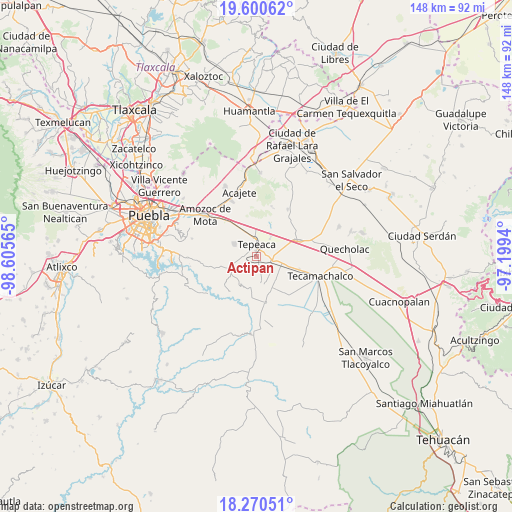
Actipan GPS coordinates[2]
18° 56' 12.804" North, 97° 54' 9.072" West
| Map corner | latitude | longitude |
|---|---|---|
| Upper-left | 19.60062°, | -98.60565° |
| Center: | 18.93689°, | -97.90252° |
| Lower-right: | 18.27051°, | -97.1994° |
| Map W x H: | 147.9×147.9 km | = 91.9×91.9mi |
| max Lat: | 32.7° ⇑66.1% North |
| Actipan: | 18.93689° |
| min Lat: | ⇓33.9% South 14.53588° |
| min Long | Actipan | max Long |
| -117.105° | -97.90252° | -86.73105° |
| W 64.8%⇐ | ⇒35.2% E |
Elevation
Elevation of Actipan is 2199 m = 7215 ft, and this is 945.3 m = 3101 ft above average elevation for this country.
| Max E: |
3497 m = 11473 ft | 17.6% |
| Actipan | 2199 m 7215 ft | |
| Avg. | 1253.7 m = 4113 ft | |
Min E: |
-1 m = -3 ft | 82.4% |
See also: Mexico elevation on elevation.city.
Geographical zone
Actipan is located in North Torrid zone (between Equator and Tropic of Cancer). Distance of this Northern Tropic circle is 500.3 km =310.9 mi to North.| Distance of | km | miles | from Actipan |
|---|---|---|---|
| North Pole | 7901.5 | 4909.8 | to North |
| Arctic Circle | 5295.6 | 3290.5 | to North |
| Tropic Cancer | 500.3 | 310.9 | to North |
| Equator | 2105.6 | 1308.4 | to South |


Nearby cities:
15 places around Actipan: (largest is in red/bold)
• Guadalupe Calderón
5.7 km =3.5 mi,  55°
55°
• Hueyotlipan
6.4 km =4 mi,  142°
142°
• Miguel Negrete
7.9 km =4.9 mi,  77°
77°
• Mixtla
3.6 km =2.2 mi,  168°
168°
• San Buenaventura
4.6 km =2.9 mi,  212°
212°
• San Hipólito
3.1 km =1.9 mi, 82°
• San José Carpinteros
6.5 km =4 mi,  351°
351°
• San Luis Ajajalpan
3.3 km =2.1 mi,  268°
268°
• San Mateo Parra
7.4 km =4.6 mi,  35°
35°
• San Nicolás Zoyapetlayoca
4.2 km =2.6 mi,  109°
109°
• San Simón Coatepec
2.8 km =1.7 mi,  149°
149°
• Santa Cruz Ajajalpan
5.3 km =3.3 mi,  288°
288°
• Santiago Acatlán
7.1 km =4.4 mi,  332°
332°
• Tepeaca
3.3 km =2.1 mi,  4°
4°
• Zahuatlán de Morelos (San José)
6.3 km =3.9 mi, 35°
Sources, notices
• [Note1] Compared only with cities in Mexico existing in our database
• [Src1] Map data: © OpenStreetMap contributors (CC-BY-SA)
• [Src2] Other city data from geonames.org with taken over terms of usage.
• [Src3] Geographical zone / Annual Mean Temperature by Robert A. Rohde @ Wikipedia
