San Salvador (Naranjillo) geodata
San Salvador (Naranjillo) (Puebla) is a populated place; located in Mexico in America/Mexico_City (GMT-6) time zone. With population of 2,371 people, there are 3726 cities with bigger population in this country. Compared to other cities in Mexico, 53.6% of cities are located further ↓South; 71.4% of cities are located further ←West and 61.4% of cities have lower elevation than San Salvador (Naranjillo). Note1
Current local time in San Salvador (Naranjillo):
06:30 AM, WednesdayDifference from your time zone: hours


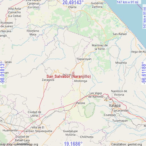
San Salvador (Naranjillo) GPS coordinates[2]
19° 49' 53.004" North, 97° 18' 54" West
| Map corner | latitude | longitude |
|---|---|---|
| Upper-left | 20.49143°, | -98.01813° |
| Center: | 19.83139°, | -97.315° |
| Lower-right: | 19.1686°, | -96.61188° |
| Map W x H: | 147.1×147.1 km | = 91.4×91.4mi |
| max Lat: | 32.7° ⇑46.4% North |
| San Salvador (Naranjillo): | 19.83139° |
| min Lat: | ⇓53.6% South 14.53588° |
| min Long | San Salvador (N | max Long |
| -117.105° | -97.315° | -86.73105° |
| W 71.4%⇐ | ⇒28.6% E |
Elevation
Elevation of San Salvador (Naranjillo) is 1749 m = 5738 ft, and this is 495.3 m = 1625 ft above average elevation for this country.
| Max E: |
3497 m = 11473 ft | 38.6% |
| San Salvador (Naranjillo) | 1749 m 5738 ft | |
| Avg. | 1253.7 m = 4113 ft | |
Min E: |
-1 m = -3 ft | 61.4% |
See also: Mexico elevation on elevation.city.
Geographical zone
San Salvador (Naranjillo) is located in North Torrid zone (between Equator and Tropic of Cancer). Distance of this Northern Tropic circle is 400.9 km =249.1 mi to North.| Distance of | km | miles | from San Salvador (Naranjillo) |
|---|---|---|---|
| North Pole | 7802 | 4847.9 | to North |
| Arctic Circle | 5196.1 | 3228.7 | to North |
| Tropic Cancer | 400.9 | 249.1 | to North |
| Equator | 2205 | 1370.1 | to South |


Nearby cities:
15 places around San Salvador (Naranjillo): (largest is in red/bold)
• Atoluca
4.8 km =3 mi,  303°
303°
• Cuaxoxpan
4.1 km =2.5 mi,  231°
231°
• Ejido Hueytamalco
4.8 km =3 mi,  2°
2°
• Huehueymico
2.1 km =1.3 mi, 301°
• Ixtahuiata (La Legua)
2.6 km =1.6 mi, 302°
• Ixticpan
3.6 km =2.2 mi,  238°
238°
• Ixtlahuaca
2.3 km =1.4 mi,  246°
246°
• Jalacingo
3.2 km =2 mi,  167°
167°
• Maxtaco
3.2 km =2 mi,  258°
258°
• Melchor Ocampo
1.3 km =0.8 mi,  43°
43°
• Ocotepec
5 km =3.1 mi,  122°
122°
• San José
3.7 km =2.3 mi,  212°
212°
• San Juan Xiutetelco
4.1 km =2.5 mi,  195°
195°
• Santiago
2.3 km =1.4 mi, 202°
• Teziutlan
5 km =3.1 mi, 251°
Sources, notices
• [Note1] Compared only with cities in Mexico existing in our database
• [Src1] Map data: © OpenStreetMap contributors (CC-BY-SA)
• [Src2] Other city data from geonames.org with taken over terms of usage.
• [Src3] Geographical zone / Annual Mean Temperature by Robert A. Rohde @ Wikipedia
