Ejido Hueytamalco geodata
Ejido Hueytamalco (Puebla) is a populated place; located in Mexico in America/Mexico_City (GMT-6) time zone. With population of 534 people, there are 15868 cities with bigger population in this country. Compared to other cities in Mexico, 54.5% of cities are located further ↓South; 71.4% of cities are located further ←West and 50.9% of cities have lower elevation than Ejido Hueytamalco. Note1


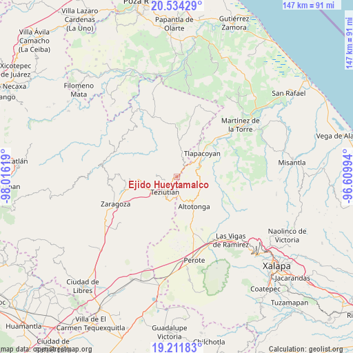
Ejido Hueytamalco GPS coordinates[2]
19° 52' 27.984" North, 97° 18' 47.016" West
| Map corner | latitude | longitude |
|---|---|---|
| Upper-left | 20.53429°, | -98.01619° |
| Center: | 19.87444°, | -97.31306° |
| Lower-right: | 19.21183°, | -96.60994° |
| Map W x H: | 147×147 km | = 91.3×91.3mi |
| max Lat: | 32.7° ⇑45.5% North |
| Ejido Hueytamalco: | 19.87444° |
| min Lat: | ⇓54.5% South 14.53588° |
| min Long | Ejido Hueytamal | max Long |
| -117.105° | -97.31306° | -86.73105° |
| W 71.4%⇐ | ⇒28.6% E |
Elevation
Elevation of Ejido Hueytamalco is 1479 m = 4852 ft, and this is 225.3 m = 739 ft above average elevation for this country.
| Max E: |
3497 m = 11473 ft | 49.1% |
| Ejido Hueytamalco | 1479 m 4852 ft | |
| Avg. | 1253.7 m = 4113 ft | |
Min E: |
-1 m = -3 ft | 50.9% |
See also: Mexico elevation on elevation.city.
Geographical zone
Ejido Hueytamalco is located in North Torrid zone (between Equator and Tropic of Cancer). Distance of this Northern Tropic circle is 396.1 km =246.1 mi to North.| Distance of | km | miles | from Ejido Hueytamalco |
|---|---|---|---|
| North Pole | 7797.2 | 4845 | to North |
| Arctic Circle | 5191.3 | 3225.7 | to North |
| Tropic Cancer | 396.1 | 246.1 | to North |
| Equator | 2209.8 | 1373.1 | to South |


Nearby cities:
15 places around Ejido Hueytamalco: (largest is in red/bold)
• Atoluca
4.8 km =3 mi,  242°
242°
• Conta
6.1 km =3.8 mi,  12°
12°
• El Mohón
5 km =3.1 mi,  41°
41°
• Epapa
5.1 km =3.2 mi, 43°
• Huehueymico
4.2 km =2.6 mi,  207°
207°
• Ixtahuiata (La Legua)
4.1 km =2.5 mi, 214°
• Ixtlahuaca
6.2 km =3.9 mi,  201°
201°
• Maxtaco
6.4 km =4 mi, 211°
• Melchor Ocampo
3.9 km =2.4 mi,  170°
170°
• Nicolás Bravo
6 km =3.7 mi,  75°
75°
• San Acateno
5.6 km =3.5 mi,  270°
270°
• San Diego
5.4 km =3.4 mi,  248°
248°
• San Juan Tezongo
6.3 km =3.9 mi, 238°
• San Salvador (Naranjillo)
4.8 km =3 mi,  182°
182°
• San Sebastián
6.4 km =4 mi, 250°
Sources, notices
• [Note1] Compared only with cities in Mexico existing in our database
• [Src1] Map data: © OpenStreetMap contributors (CC-BY-SA)
• [Src2] Other city data from geonames.org with taken over terms of usage.
• [Src3] Geographical zone / Annual Mean Temperature by Robert A. Rohde @ Wikipedia
