Tz'Aquiviljok geodata
Tz'Aquiviljok (Chiapas) is a populated place; located in Mexico in America/Mexico_City (GMT-6) time zone. With population of 2,176 people, there are 4039 cities with bigger population in this country. Compared to other cities in Mexico, 91% of cities are located further ↑North; 92.2% of cities are located further ←West and 50.4% of cities have lower elevation than Tz'Aquiviljok. Note1


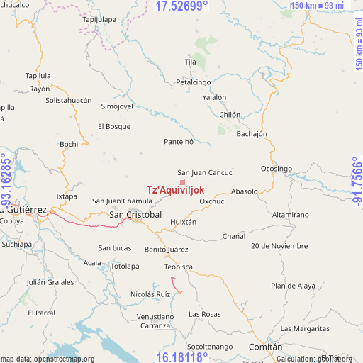
Tz'Aquiviljok GPS coordinates[2]
16° 51' 19.008" North, 92° 27' 34.992" West
| Map corner | latitude | longitude |
|---|---|---|
| Upper-left | 17.52699°, | -93.16285° |
| Center: | 16.85528°, | -92.45972° |
| Lower-right: | 16.18118°, | -91.7566° |
| Map W x H: | 149.6×149.6 km | = 93×93mi |
| max Lat: | 32.7° ⇑91% North |
| Tz'Aquiviljok: | 16.85528° |
| min Lat: | ⇓9% South 14.53588° |
| min Long | Tz'Aquiviljok | max Long |
| -117.105° | -92.45972° | -86.73105° |
| W 92.2%⇐ | ⇒7.8% E |
Elevation
Elevation of Tz'Aquiviljok is 1454 m = 4770 ft, and this is 200.3 m = 657 ft above average elevation for this country.
| Max E: |
3497 m = 11473 ft | 49.6% |
| Tz'Aquiviljok | 1454 m 4770 ft | |
| Avg. | 1253.7 m = 4113 ft | |
Min E: |
-1 m = -3 ft | 50.4% |
See also: Mexico elevation on elevation.city.
Geographical zone
Tz'Aquiviljok is located in North Torrid zone (between Equator and Tropic of Cancer). Distance of this Northern Tropic circle is 731.8 km =454.7 mi to North.| Distance of | km | miles | from Tz'Aquiviljok |
|---|---|---|---|
| North Pole | 8132.9 | 5053.5 | to North |
| Arctic Circle | 5527 | 3434.3 | to North |
| Tropic Cancer | 731.8 | 454.7 | to North |
| Equator | 1874.1 | 1164.5 | to South |


Nearby cities:
15 places around Tz'Aquiviljok: (largest is in red/bold)
• Chacoma
4.1 km =2.5 mi,  304°
304°
• Chana
3.8 km =2.4 mi,  330°
330°
• Chixtontic
4 km =2.5 mi,  2°
2°
• Cruzchén
3.1 km =1.9 mi,  203°
203°
• Jerusalén
1.8 km =1.1 mi,  209°
209°
• Kotolte
1 km =0.6 mi,  351°
351°
• Kulaktik
2.6 km =1.6 mi,  322°
322°
• Nailchén
3.3 km =2.1 mi,  55°
55°
• Ococh
2.5 km =1.6 mi,  220°
220°
• Shishintonil
2.7 km =1.7 mi,  253°
253°
• Sibaniljá Pocolum
2.4 km =1.5 mi,  356°
356°
• Tzajalchén
1.5 km =0.9 mi,  181°
181°
• Yashanal
3 km =1.9 mi,  164°
164°
• Yetzucum
3.6 km =2.2 mi,  28°
28°
• Yoshib
1.8 km =1.1 mi,  127°
127°
Sources, notices
• [Note1] Compared only with cities in Mexico existing in our database
• [Src1] Map data: © OpenStreetMap contributors (CC-BY-SA)
• [Src2] Other city data from geonames.org with taken over terms of usage.
• [Src3] Geographical zone / Annual Mean Temperature by Robert A. Rohde @ Wikipedia
