Chana geodata
Chana (Chiapas) is a populated place; located in Mexico in America/Mexico_City (GMT-6) time zone. With population of 508 people, there are 16554 cities with bigger population in this country. Compared to other cities in Mexico, 90.5% of cities are located further ↑North; 92.1% of cities are located further ←West and 50.4% of cities have lower elevation than Chana. Note1


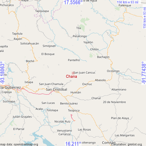
Chana GPS coordinates[2]
16° 53' 6" North, 92° 28' 39" West
| Map corner | latitude | longitude |
|---|---|---|
| Upper-left | 17.5566°, | -93.18063° |
| Center: | 16.885°, | -92.4775° |
| Lower-right: | 16.211°, | -91.77438° |
| Map W x H: | 149.6×149.6 km | = 93×93mi |
| max Lat: | 32.7° ⇑90.5% North |
| Chana: | 16.885° |
| min Lat: | ⇓9.5% South 14.53588° |
| min Long | Chana | max Long |
| -117.105° | -92.4775° | -86.73105° |
| W 92.1%⇐ | ⇒7.9% E |
Elevation
Elevation of Chana is 1453 m = 4767 ft, and this is 199.3 m = 654 ft above average elevation for this country.
| Max E: |
3497 m = 11473 ft | 49.6% |
| Chana | 1453 m 4767 ft | |
| Avg. | 1253.7 m = 4113 ft | |
Min E: |
-1 m = -3 ft | 50.4% |
See also: Mexico elevation on elevation.city.
Geographical zone
Chana is located in North Torrid zone (between Equator and Tropic of Cancer). Distance of this Northern Tropic circle is 728.5 km =452.7 mi to North.| Distance of | km | miles | from Chana |
|---|---|---|---|
| North Pole | 8129.6 | 5051.5 | to North |
| Arctic Circle | 5523.7 | 3432.3 | to North |
| Tropic Cancer | 728.5 | 452.7 | to North |
| Equator | 1877.4 | 1166.6 | to South |


Nearby cities:
15 places around Chana: (largest is in red/bold)
• Cancuc
3.6 km =2.2 mi,  350°
350°
• Chacoma
1.8 km =1.1 mi,  236°
236°
• Chixtontic
2.2 km =1.4 mi,  72°
72°
• Cruz Pilar
4 km =2.5 mi,  49°
49°
• Jomanichim
1.8 km =1.1 mi,  17°
17°
• Juxalja
2.1 km =1.3 mi, 49°
• Kotolte
2.9 km =1.8 mi,  142°
142°
• Kulaktik
1.3 km =0.8 mi,  165°
165°
• Pactetón
2.2 km =1.4 mi, 351°
• Shishintonil
4.1 km =2.5 mi,  190°
190°
• Sibaniljá Pocolum
2 km =1.2 mi,  118°
118°
• Sivactel
3.7 km =2.3 mi,  281°
281°
• Tres Cerros
3.4 km =2.1 mi,  8°
8°
• Tz'Aquiviljok
3.8 km =2.4 mi,  150°
150°
• Yetzucum
3.6 km =2.2 mi,  91°
91°
Sources, notices
• [Note1] Compared only with cities in Mexico existing in our database
• [Src1] Map data: © OpenStreetMap contributors (CC-BY-SA)
• [Src2] Other city data from geonames.org with taken over terms of usage.
• [Src3] Geographical zone / Annual Mean Temperature by Robert A. Rohde @ Wikipedia
