Gunyo Poniente (San José Gunyo) geodata
Gunyo Poniente (San José Gunyo) (State of Mexico) is a populated place; located in Mexico in America/Mexico_City (GMT-6) time zone. With population of 2,138 people, there are 4096 cities with bigger population in this country. Compared to other cities in Mexico, 59.4% of cities are located further ↓South; 62% of cities are located further →East and 90.3% of cities have lower elevation than Gunyo Poniente (San José Gunyo). Note1
Current local time in Gunyo Poniente (San José Gunyo):
07:44 AM, MondayDifference from your time zone: hours


Gunyo Poniente (San José Gunyo) GPS coordinates[2]
20° 6' 41.364" North, 99° 50' 18.996" West
| Map corner | latitude | longitude |
|---|---|---|
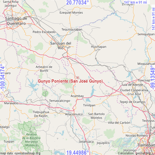
| Upper-left | 20.77034°, | -100.54174° |
| Center: | 20.11149°, | -99.83861° |
| Lower-right: | 19.44986°, | -99.13549° |
| Map W x H: | 146.8×146.8 km | = 91.2×91.2mi |
| max Lat: | 32.7° ⇑40.6% North |
| Gunyo Poniente (San José Gunyo): | 20.11149° |
| min Lat: | ⇓59.4% South 14.53588° |
| min Long | Gunyo Poniente | max Long |
| -117.105° | -99.83861° | -86.73105° |
| W 38%⇐ | ⇒62% E |
Elevation
Elevation of Gunyo Poniente (San José Gunyo) is 2418 m = 7933 ft, and this is 1164.3 m = 3820 ft above average elevation for this country.
| Max E: |
3497 m = 11473 ft | 9.7% |
| Gunyo Poniente (San José Gunyo) | 2418 m 7933 ft | |
| Avg. | 1253.7 m = 4113 ft | |
Min E: |
-1 m = -3 ft | 90.3% |
See also: Mexico elevation on elevation.city.
Geographical zone
Gunyo Poniente (San José Gunyo) is located in North Torrid zone (between Equator and Tropic of Cancer). Distance of this Northern Tropic circle is 369.7 km =229.7 mi to North.| Distance of | km | miles | from Gunyo Poniente (San José Gunyo) |
|---|---|---|---|
| North Pole | 7770.9 | 4828.6 | to North |
| Arctic Circle | 5165 | 3209.4 | to North |
| Tropic Cancer | 369.7 | 229.7 | to North |
| Equator | 2236.2 | 1389.5 | to South |


Nearby cities:
15 places around Gunyo Poniente (San José Gunyo): (largest is in red/bold)
• Aculco de Espinoza
1.8 km =1.1 mi,  141°
141°
• Bañe
9.4 km =5.8 mi,  357°
357°
• El Colorado
8.1 km =5 mi,  101°
101°
• Fondo
9.6 km =6 mi,  127°
127°
• Gunyo Oriente
2.5 km =1.6 mi,  74°
74°
• La Concepción Ejido
4.3 km =2.7 mi,  303°
303°
• La Concepción Pueblo
9.8 km =6.1 mi,  293°
293°
• La Presita Segundo Cuartel
6.7 km =4.2 mi,  327°
327°
• La Soledad Barrio
2.7 km =1.7 mi, 143°
• La Soledad Ejido
3.2 km =2 mi,  210°
210°
• Las Lajas
9.2 km =5.7 mi,  93°
93°
• San Antonio Pueblo
8.3 km =5.2 mi,  273°
273°
• San Lucas Totolmaloya
8.4 km =5.2 mi,  313°
313°
• Santa María Nativitas
4.7 km =2.9 mi,  117°
117°
• Ñado Buenavista
6.2 km =3.9 mi,  200°
200°
Sources, notices
• [Note1] Compared only with cities in Mexico existing in our database
• [Src1] Map data: © OpenStreetMap contributors (CC-BY-SA)
• [Src2] Other city data from geonames.org with taken over terms of usage.
• [Src3] Geographical zone / Annual Mean Temperature by Robert A. Rohde @ Wikipedia
