Gunyo Oriente geodata
Gunyo Oriente (State of Mexico) is a populated place; located in Mexico in America/Mexico_City (GMT-6) time zone. With population of 602 people, there are 14290 cities with bigger population in this country. Compared to other cities in Mexico, 59.6% of cities are located further ↓South; 61.6% of cities are located further →East and 91.6% of cities have lower elevation than Gunyo Oriente. Note1


Gunyo Oriente GPS coordinates[2]
20° 7' 3" North, 99° 48' 55.008" West
| Map corner | latitude | longitude |
|---|---|---|
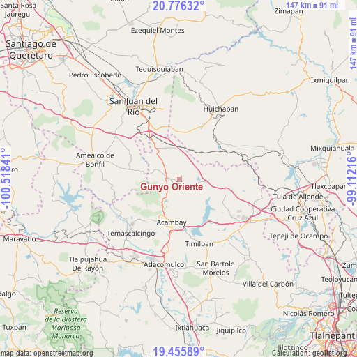
| Upper-left | 20.77632°, | -100.51841° |
| Center: | 20.1175°, | -99.81528° |
| Lower-right: | 19.45589°, | -99.11216° |
| Map W x H: | 146.8×146.8 km | = 91.2×91.2mi |
| max Lat: | 32.7° ⇑40.4% North |
| Gunyo Oriente: | 20.1175° |
| min Lat: | ⇓59.6% South 14.53588° |
| min Long | Gunyo Oriente | max Long |
| -117.105° | -99.81528° | -86.73105° |
| W 38.4%⇐ | ⇒61.6% E |
Elevation
Elevation of Gunyo Oriente is 2461 m = 8074 ft, and this is 1207.3 m = 3961 ft above average elevation for this country.
| Max E: |
3497 m = 11473 ft | 8.4% |
| Gunyo Oriente | 2461 m 8074 ft | |
| Avg. | 1253.7 m = 4113 ft | |
Min E: |
-1 m = -3 ft | 91.6% |
See also: Mexico elevation on elevation.city.
Geographical zone
Gunyo Oriente is located in North Torrid zone (between Equator and Tropic of Cancer). Distance of this Northern Tropic circle is 369.1 km =229.3 mi to North.| Distance of | km | miles | from Gunyo Oriente |
|---|---|---|---|
| North Pole | 7770.2 | 4828.2 | to North |
| Arctic Circle | 5164.3 | 3208.9 | to North |
| Tropic Cancer | 369.1 | 229.3 | to North |
| Equator | 2236.9 | 1389.9 | to South |


Nearby cities:
15 places around Gunyo Oriente: (largest is in red/bold)
• Aculco de Espinoza
2.5 km =1.6 mi,  211°
211°
• Bañe
9.2 km =5.7 mi,  341°
341°
• El Bonxhi
9.2 km =5.7 mi,  120°
120°
• El Colorado
6 km =3.7 mi,  113°
113°
• Fondo
8.3 km =5.2 mi,  141°
141°
• Gunyo Poniente (San José Gunyo)
2.5 km =1.6 mi,  254°
254°
• La Concepción Ejido
6.3 km =3.9 mi,  286°
286°
• La Presita Segundo Cuartel
7.8 km =4.8 mi,  309°
309°
• La Soledad Barrio
3 km =1.9 mi,  195°
195°
• La Soledad Ejido
5.3 km =3.3 mi,  229°
229°
• Las Lajas
6.8 km =4.2 mi,  100°
100°
• San Antonio Arroyo Zarco
9 km =5.6 mi, 110°
• San Lucas Totolmaloya
10 km =6.2 mi,  300°
300°
• Santa María Nativitas
3.4 km =2.1 mi,  148°
148°
• Ñado Buenavista
7.9 km =4.9 mi,  215°
215°
Sources, notices
• [Note1] Compared only with cities in Mexico existing in our database
• [Src1] Map data: © OpenStreetMap contributors (CC-BY-SA)
• [Src2] Other city data from geonames.org with taken over terms of usage.
• [Src3] Geographical zone / Annual Mean Temperature by Robert A. Rohde @ Wikipedia
