Ñado Buenavista geodata
Ñado Buenavista (State of Mexico) is a populated place; located in Mexico in America/Mexico_City (GMT-6) time zone. With population of 753 people, there are 11637 cities with bigger population in this country. Compared to other cities in Mexico, 58.3% of cities are located further ↓South; 62.2% of cities are located further →East and 92.8% of cities have lower elevation than Ñado Buenavista. Note1


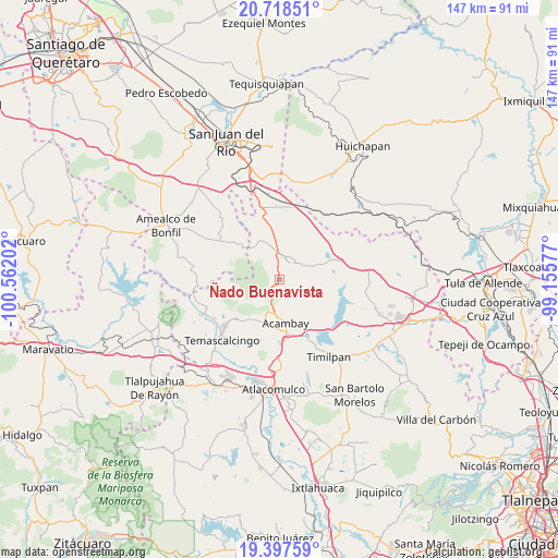
Ñado Buenavista GPS coordinates[2]
20° 3' 33.984" North, 99° 51' 32.004" West
| Map corner | latitude | longitude |
|---|---|---|
| Upper-left | 20.71851°, | -100.56202° |
| Center: | 20.05944°, | -99.85889° |
| Lower-right: | 19.39759°, | -99.15577° |
| Map W x H: | 146.9×146.9 km | = 91.3×91.3mi |
| max Lat: | 32.7° ⇑41.7% North |
| Ñado Buenavista: | 20.05944° |
| min Lat: | ⇓58.3% South 14.53588° |
| min Long | Ñado Buenavist | max Long |
| -117.105° | -99.85889° | -86.73105° |
| W 37.8%⇐ | ⇒62.2% E |
Elevation
Elevation of Ñado Buenavista is 2518 m = 8261 ft, and this is 1264.3 m = 4148 ft above average elevation for this country.
| Max E: |
3497 m = 11473 ft | 7.2% |
| Ñado Buenavista | 2518 m 8261 ft | |
| Avg. | 1253.7 m = 4113 ft | |
Min E: |
-1 m = -3 ft | 92.8% |
See also: Mexico elevation on elevation.city.
Geographical zone
Ñado Buenavista is located in North Torrid zone (between Equator and Tropic of Cancer). Distance of this Northern Tropic circle is 375.5 km =233.3 mi to North.| Distance of | km | miles | from Ñado Buenavista |
|---|---|---|---|
| North Pole | 7776.7 | 4832.2 | to North |
| Arctic Circle | 5170.8 | 3213 | to North |
| Tropic Cancer | 375.5 | 233.3 | to North |
| Equator | 2230.4 | 1385.9 | to South |


Nearby cities:
15 places around Ñado Buenavista: (largest is in red/bold)
• Aculco de Espinoza
5.5 km =3.4 mi,  36°
36°
• Botidi
10.5 km =6.5 mi,  170°
170°
• Buenavista
8.6 km =5.3 mi,  131°
131°
• Detiña (San Antonio Detiña)
10.3 km =6.4 mi,  194°
194°
• Fondo
9.7 km =6 mi,  89°
89°
• Ganzda
7.8 km =4.8 mi, 171°
• Gunyo Oriente
7.9 km =4.9 mi, 35°
• Gunyo Poniente (San José Gunyo)
6.2 km =3.9 mi,  20°
20°
• La Concepción Ejido
8.3 km =5.2 mi,  349°
349°
• La Palma
7.6 km =4.7 mi,  225°
225°
• La Soledad Barrio
5.2 km =3.2 mi,  45°
45°
• La Soledad Ejido
3.1 km =1.9 mi,  9°
9°
• Loma Linda
6.6 km =4.1 mi,  143°
143°
• San Antonio Pueblo
8.9 km =5.5 mi,  315°
315°
• Santa María Nativitas
7.3 km =4.5 mi,  60°
60°
Sources, notices
• [Note1] Compared only with cities in Mexico existing in our database
• [Src1] Map data: © OpenStreetMap contributors (CC-BY-SA)
• [Src2] Other city data from geonames.org with taken over terms of usage.
• [Src3] Geographical zone / Annual Mean Temperature by Robert A. Rohde @ Wikipedia
