Fondo geodata
Fondo (State of Mexico) is a populated place; located in Mexico in America/Mexico_City (GMT-6) time zone. With population of 761 people, there are 11509 cities with bigger population in this country. Compared to other cities in Mexico, 58.3% of cities are located further ↓South; 61.1% of cities are located further →East and 95.9% of cities have lower elevation than Fondo. Note1


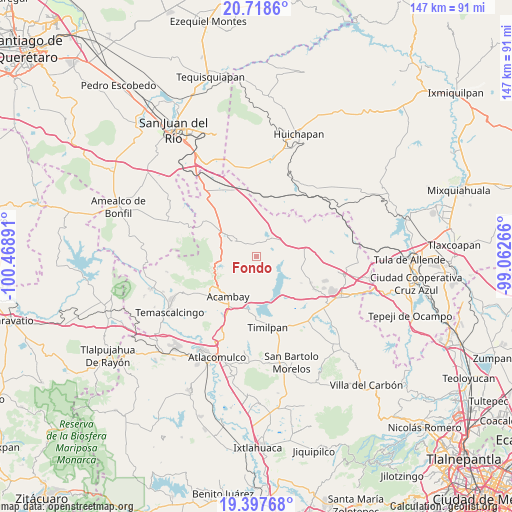
Fondo GPS coordinates[2]
20° 3' 34.308" North, 99° 45' 56.808" West
| Map corner | latitude | longitude |
|---|---|---|
| Upper-left | 20.7186°, | -100.46891° |
| Center: | 20.05953°, | -99.76578° |
| Lower-right: | 19.39768°, | -99.06266° |
| Map W x H: | 146.9×146.9 km | = 91.3×91.3mi |
| max Lat: | 32.7° ⇑41.7% North |
| Fondo: | 20.05953° |
| min Lat: | ⇓58.3% South 14.53588° |
| min Long | Fondo | max Long |
| -117.105° | -99.76578° | -86.73105° |
| W 38.9%⇐ | ⇒61.1% E |
Elevation
Elevation of Fondo is 2623 m = 8606 ft, and this is 1369.3 m = 4492 ft above average elevation for this country.
| Max E: |
3497 m = 11473 ft | 4.1% |
| Fondo | 2623 m 8606 ft | |
| Avg. | 1253.7 m = 4113 ft | |
Min E: |
-1 m = -3 ft | 95.9% |
See also: Mexico elevation on elevation.city.
Geographical zone
Fondo is located in North Torrid zone (between Equator and Tropic of Cancer). Distance of this Northern Tropic circle is 375.5 km =233.3 mi to North.| Distance of | km | miles | from Fondo |
|---|---|---|---|
| North Pole | 7776.7 | 4832.2 | to North |
| Arctic Circle | 5170.8 | 3213 | to North |
| Tropic Cancer | 375.5 | 233.3 | to North |
| Equator | 2230.4 | 1385.9 | to South |


Nearby cities:
15 places around Fondo: (largest is in red/bold)
• Aculco de Espinoza
7.8 km =4.8 mi,  303°
303°
• Buenavista
6.6 km =4.1 mi,  210°
210°
• El Bonxhi
3.2 km =2 mi,  56°
56°
• El Colorado
4.1 km =2.5 mi,  4°
4°
• El Rosal
9.6 km =6 mi, 61°
• Gunyo Oriente
8.3 km =5.2 mi,  321°
321°
• Gunyo Poniente (San José Gunyo)
9.6 km =6 mi,  307°
307°
• La Soledad Barrio
7 km =4.3 mi, 301°
• Las Arenas (San Agustín)
8.6 km =5.3 mi,  153°
153°
• Las Lajas
5.4 km =3.4 mi,  16°
16°
• Loma Linda
7.9 km =4.9 mi,  227°
227°
• Los Pilares
7.6 km =4.7 mi,  140°
140°
• San Antonio Arroyo Zarco
4.6 km =2.9 mi,  45°
45°
• San Martín Ejido
7.6 km =4.7 mi,  79°
79°
• Santa María Nativitas
4.9 km =3 mi, 316°
Sources, notices
• [Note1] Compared only with cities in Mexico existing in our database
• [Src1] Map data: © OpenStreetMap contributors (CC-BY-SA)
• [Src2] Other city data from geonames.org with taken over terms of usage.
• [Src3] Geographical zone / Annual Mean Temperature by Robert A. Rohde @ Wikipedia
