El Esclavo geodata
El Esclavo (State of Mexico) is a populated place; located in Mexico in America/Mexico_City (GMT-6) time zone. With population of 1,860 people, there are 4671 cities with bigger population in this country. Compared to other cities in Mexico, 50.3% of cities are located further ↑North; 55.2% of cities are located further →East and 93.2% of cities have lower elevation than El Esclavo. Note1


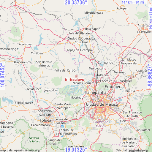
El Esclavo GPS coordinates[2]
19° 40' 36.012" North, 99° 22' 17.004" West
| Map corner | latitude | longitude |
|---|---|---|
| Upper-left | 20.33736°, | -100.07452° |
| Center: | 19.67667°, | -99.37139° |
| Lower-right: | 19.01325°, | -98.66827° |
| Map W x H: | 147.2×147.2 km | = 91.5×91.5mi |
| max Lat: | 32.7° ⇑50.3% North |
| El Esclavo: | 19.67667° |
| min Lat: | ⇓49.7% South 14.53588° |
| min Long | El Esclavo | max Long |
| -117.105° | -99.37139° | -86.73105° |
| W 44.8%⇐ | ⇒55.2% E |
Elevation
Elevation of El Esclavo is 2542 m = 8340 ft, and this is 1288.3 m = 4227 ft above average elevation for this country.
| Max E: |
3497 m = 11473 ft | 6.8% |
| El Esclavo | 2542 m 8340 ft | |
| Avg. | 1253.7 m = 4113 ft | |
Min E: |
-1 m = -3 ft | 93.2% |
See also: Mexico elevation on elevation.city.
Geographical zone
El Esclavo is located in North Torrid zone (between Equator and Tropic of Cancer). Distance of this Northern Tropic circle is 418.1 km =259.8 mi to North.| Distance of | km | miles | from El Esclavo |
|---|---|---|---|
| North Pole | 7819.2 | 4858.6 | to North |
| Arctic Circle | 5213.3 | 3239.4 | to North |
| Tropic Cancer | 418.1 | 259.8 | to North |
| Equator | 2187.8 | 1359.4 | to South |


Nearby cities:
15 places around El Esclavo: (largest is in red/bold)
• Caja de Agua
3.8 km =2.4 mi,  169°
169°
• Cañada de Cisneros
4.3 km =2.7 mi,  60°
60°
• Colonia Morelos
5.5 km =3.4 mi,  142°
142°
• Colonia San Miguel
2.7 km =1.7 mi,  220°
220°
• Colonia el Mirador
1.6 km =1 mi,  110°
110°
• El Puerto Magú
1.3 km =0.8 mi,  353°
353°
• Joya del Tejocote
4.5 km =2.8 mi,  150°
150°
• Loma Larga
6.1 km =3.8 mi, 154°
• Loma de Guadalupe (La Biznaga)
2.7 km =1.7 mi, 174°
• Loma de San José
6 km =3.7 mi,  129°
129°
• Progreso Industrial
4.7 km =2.9 mi,  161°
161°
• San Francisco Magú
2.6 km =1.6 mi,  68°
68°
• San José el Vidrio
2.9 km =1.8 mi,  207°
207°
• San Juan de las Tablas
5.3 km =3.3 mi,  265°
265°
• San Miguel Cañadas
5.8 km =3.6 mi,  28°
28°
Sources, notices
• [Note1] Compared only with cities in Mexico existing in our database
• [Src1] Map data: © OpenStreetMap contributors (CC-BY-SA)
• [Src2] Other city data from geonames.org with taken over terms of usage.
• [Src3] Geographical zone / Annual Mean Temperature by Robert A. Rohde @ Wikipedia
