San Martín Tlapala geodata
San Martín Tlapala (Puebla) is a populated place; located in Mexico in America/Mexico_City (GMT-6) time zone. With population of 1,415 people, there are 6109 cities with bigger population in this country. Compared to other cities in Mexico, 65.4% of cities are located further ↑North; 57.8% of cities are located further ←West and 79.2% of cities have lower elevation than San Martín Tlapala. Note1


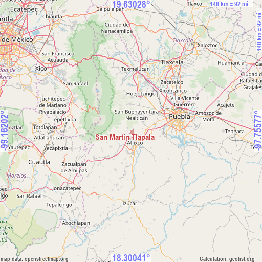
San Martín Tlapala GPS coordinates[2]
18° 58' 0.012" North, 98° 27' 32.004" West
| Map corner | latitude | longitude |
|---|---|---|
| Upper-left | 19.63028°, | -99.16202° |
| Center: | 18.96667°, | -98.45889° |
| Lower-right: | 18.30041°, | -97.75577° |
| Map W x H: | 147.9×147.9 km | = 91.9×91.9mi |
| max Lat: | 32.7° ⇑65.4% North |
| San Martín Tlapala: | 18.96667° |
| min Lat: | ⇓34.6% South 14.53588° |
| min Long | San Martín Tla | max Long |
| -117.105° | -98.45889° | -86.73105° |
| W 57.8%⇐ | ⇒42.2% E |
Elevation
Elevation of San Martín Tlapala is 2122 m = 6962 ft, and this is 868.3 m = 2849 ft above average elevation for this country.
| Max E: |
3497 m = 11473 ft | 20.8% |
| San Martín Tlapala | 2122 m 6962 ft | |
| Avg. | 1253.7 m = 4113 ft | |
Min E: |
-1 m = -3 ft | 79.2% |
See also: Mexico elevation on elevation.city.
Geographical zone
San Martín Tlapala is located in North Torrid zone (between Equator and Tropic of Cancer). Distance of this Northern Tropic circle is 497 km =308.8 mi to North.| Distance of | km | miles | from San Martín Tlapala |
|---|---|---|---|
| North Pole | 7898.2 | 4907.7 | to North |
| Arctic Circle | 5292.3 | 3288.5 | to North |
| Tropic Cancer | 497 | 308.8 | to North |
| Equator | 2108.9 | 1310.4 | to South |


Nearby cities:
15 places around San Martín Tlapala: (largest is in red/bold)
• Atlixco
6.9 km =4.3 mi,  159°
159°
• Ciudad de Atlixco
7.3 km =4.5 mi, 163°
• Colonia Agrícola de Ocotepec (Colonia San José)
9.9 km =6.2 mi,  245°
245°
• El Encanto del Cerril
5.2 km =3.2 mi,  137°
137°
• Emiliano Zapata los Molinos
7.1 km =4.4 mi,  106°
106°
• Nealtican
9.8 km =6.1 mi,  19°
19°
• San Agustín Huixaxtla
8.5 km =5.3 mi,  129°
129°
• San Baltazar Atlimeyaya
3.2 km =2 mi,  313°
313°
• San Félix Hidalgo
9.8 km =6.1 mi, 140°
• San Juan Tejaluca
9.4 km =5.8 mi, 142°
• San Martín Tlamapa
6.6 km =4.1 mi,  79°
79°
• Santa Ana Acozautla
8.1 km =5 mi,  98°
98°
• Santa Isabel Cholula
9 km =5.6 mi,  68°
68°
• Tecuanipan
8.2 km =5.1 mi,  50°
50°
• Tianguismanalco
1.5 km =0.9 mi, 45°
Sources, notices
• [Note1] Compared only with cities in Mexico existing in our database
• [Src1] Map data: © OpenStreetMap contributors (CC-BY-SA)
• [Src2] Other city data from geonames.org with taken over terms of usage.
• [Src3] Geographical zone / Annual Mean Temperature by Robert A. Rohde @ Wikipedia
