Soyatlán de Afuera geodata
Soyatlán de Afuera (Jalisco) is a populated place; located in Mexico in America/Mexico_City (GMT-6) time zone. With population of 1,543 people, there are 5591 cities with bigger population in this country. Compared to other cities in Mexico, 50.2% of cities are located further ↓South; 87.1% of cities are located further →East and 56.7% of cities have higher elevation than Soyatlán de Afuera. Note1


Soyatlán de Afuera GPS coordinates[2]
19° 41' 26.988" North, 103° 16' 58.008" West
| Map corner | latitude | longitude |
|---|---|---|
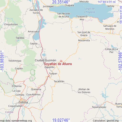
| Upper-left | 20.35146°, | -103.98591° |
| Center: | 19.69083°, | -103.28278° |
| Lower-right: | 19.02746°, | -102.57966° |
| Map W x H: | 147.2×147.2 km | = 91.5×91.5mi |
| max Lat: | 32.7° ⇑49.8% North |
| Soyatlán de Afuera: | 19.69083° |
| min Lat: | ⇓50.2% South 14.53588° |
| min Long | Soyatlán de Af | max Long |
| -117.105° | -103.28278° | -86.73105° |
| W 12.9%⇐ | ⇒87.1% E |
Elevation
Elevation of Soyatlán de Afuera is 1133 m = 3717 ft, and this is 120.7 m = 396 ft below average elevation for this country.
| Max E: |
3497 m = 11473 ft | 56.7% |
| Avg. | 1253.7 m = 4113 ft | |
| Soyatlán de Afuera | 1133 m = 3717 ft | |
Min E: |
-1 m = -3 ft | 43.3% |
See also: Mexico elevation on elevation.city.
Geographical zone
Soyatlán de Afuera is located in North Torrid zone (between Equator and Tropic of Cancer). Distance of this Northern Tropic circle is 416.5 km =258.8 mi to North.| Distance of | km | miles | from Soyatlán de Afuera |
|---|---|---|---|
| North Pole | 7817.6 | 4857.6 | to North |
| Arctic Circle | 5211.8 | 3238.5 | to North |
| Tropic Cancer | 416.5 | 258.8 | to North |
| Equator | 2189.4 | 1360.4 | to South |


Nearby cities:
15 places around Soyatlán de Afuera: (largest is in red/bold)
• Callejones
3.3 km =2.1 mi,  140°
140°
• Ciudad Guzmán
18.8 km =11.7 mi,  274°
274°
• El Coahuayote (El Arco)
11.8 km =7.3 mi,  220°
220°
• El Rincón
12.8 km =8 mi,  258°
258°
• La Garita
19.3 km =12 mi,  60°
60°
• La Purísima
22.6 km =14 mi,  192°
192°
• Paso de Ganado
8.4 km =5.2 mi,  66°
66°
• San Francisco
9.8 km =6.1 mi, 72°
• San Sebastián del Sur
23 km =14.3 mi,  300°
300°
• San Vicente
5.7 km =3.5 mi, 143°
• Tamazula de Gordiano
3.5 km =2.2 mi,  110°
110°
• Tasinaxtla (La Cañada)
12.4 km =7.7 mi, 187°
• Tuxpan
17.9 km =11.1 mi,  212°
212°
• Vista Hermosa
5.9 km =3.7 mi, 273°
• Zapotiltic
15.8 km =9.8 mi,  243°
243°
Sources, notices
• [Note1] Compared only with cities in Mexico existing in our database
• [Src1] Map data: © OpenStreetMap contributors (CC-BY-SA)
• [Src2] Other city data from geonames.org with taken over terms of usage.
• [Src3] Geographical zone / Annual Mean Temperature by Robert A. Rohde @ Wikipedia
