La Garita geodata
La Garita (Jalisco) is a populated place; located in Mexico in America/Mexico_City (GMT-6) time zone. With population of 1,060 people, there are 8236 cities with bigger population in this country. Compared to other cities in Mexico, 52.1% of cities are located further ↓South; 86.2% of cities are located further →East and 55.1% of cities have higher elevation than La Garita. Note1


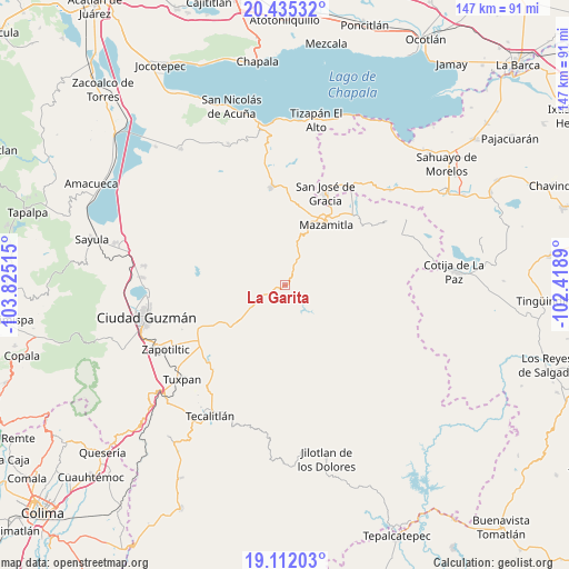
La Garita GPS coordinates[2]
19° 46' 30.18" North, 103° 7' 19.272" West
| Map corner | latitude | longitude |
|---|---|---|
| Upper-left | 20.43532°, | -103.82515° |
| Center: | 19.77505°, | -103.12202° |
| Lower-right: | 19.11203°, | -102.4189° |
| Map W x H: | 147.1×147.1 km | = 91.4×91.4mi |
| max Lat: | 32.7° ⇑47.9% North |
| La Garita: | 19.77505° |
| min Lat: | ⇓52.1% South 14.53588° |
| min Long | La Garita | max Long |
| -117.105° | -103.12202° | -86.73105° |
| W 13.8%⇐ | ⇒86.2% E |
Elevation
Elevation of La Garita is 1192 m = 3911 ft, and this is 61.7 m = 202 ft below average elevation for this country.
| Max E: |
3497 m = 11473 ft | 55.1% |
| Avg. | 1253.7 m = 4113 ft | |
| La Garita | 1192 m = 3911 ft | |
Min E: |
-1 m = -3 ft | 44.9% |
See also: Mexico elevation on elevation.city.
Geographical zone
La Garita is located in North Torrid zone (between Equator and Tropic of Cancer). Distance of this Northern Tropic circle is 407.1 km =253 mi to North.| Distance of | km | miles | from La Garita |
|---|---|---|---|
| North Pole | 7808.3 | 4851.9 | to North |
| Arctic Circle | 5202.4 | 3232.6 | to North |
| Tropic Cancer | 407.1 | 253 | to North |
| Equator | 2198.8 | 1366.3 | to South |


Nearby cities:
15 places around La Garita: (largest is in red/bold)
• Callejones
18.9 km =11.7 mi,  231°
231°
• Concepción de Buenos Aires
26.8 km =16.7 mi,  327°
327°
• Epeche Chico (Penche Chico)
21.2 km =13.2 mi,  30°
30°
• La Manzanilla de la Paz
25.8 km =16 mi,  352°
352°
• Mazamitla
19 km =11.8 mi, 34°
• Paso de Ganado
11 km =6.8 mi,  236°
236°
• Paso de Piedra
28.6 km =17.8 mi,  38°
38°
• San Francisco
9.8 km =6.1 mi, 229°
• San José de Gracia
26.1 km =16.2 mi,  23°
23°
• San Vicente
19.4 km =12.1 mi,  224°
224°
• Soyatlán de Afuera
19.3 km =12 mi, 240°
• Tamazula de Gordiano
17.2 km =10.7 mi, 232°
• Tasinaxtla (La Cañada)
28.5 km =17.7 mi, 220°
• Valle de Juárez
25.6 km =15.9 mi,  46°
46°
• Vista Hermosa
24.5 km =15.2 mi,  248°
248°
Sources, notices
• [Note1] Compared only with cities in Mexico existing in our database
• [Src1] Map data: © OpenStreetMap contributors (CC-BY-SA)
• [Src2] Other city data from geonames.org with taken over terms of usage.
• [Src3] Geographical zone / Annual Mean Temperature by Robert A. Rohde @ Wikipedia
