San Antonio Xoquitla geodata
San Antonio Xoquitla (Veracruz) is a populated place; located in Mexico in America/Mexico_City (GMT-6) time zone. With population of 1,415 people, there are 6109 cities with bigger population in this country. Compared to other cities in Mexico, 57.8% of cities are located further ↑North; 72.8% of cities are located further ←West and 81.6% of cities have lower elevation than San Antonio Xoquitla. Note1
Current local time in San Antonio Xoquitla:
08:27 AM, WednesdayDifference from your time zone: hours


San Antonio Xoquitla GPS coordinates[2]
19° 20' 26.016" North, 97° 9' 54" West
| Map corner | latitude | longitude |
|---|---|---|
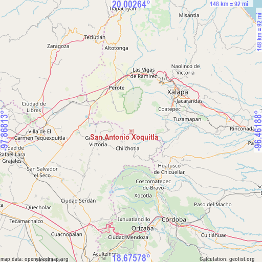
| Upper-left | 20.00264°, | -97.86813° |
| Center: | 19.34056°, | -97.165° |
| Lower-right: | 18.67578°, | -96.46188° |
| Map W x H: | 147.5×147.5 km | = 91.7×91.7mi |
| max Lat: | 32.7° ⇑57.8% North |
| San Antonio Xoquitla: | 19.34056° |
| min Lat: | ⇓42.2% South 14.53588° |
| min Long | San Antonio Xoq | max Long |
| -117.105° | -97.165° | -86.73105° |
| W 72.8%⇐ | ⇒27.2% E |
Elevation
Elevation of San Antonio Xoquitla is 2179 m = 7149 ft, and this is 925.3 m = 3036 ft above average elevation for this country.
| Max E: |
3497 m = 11473 ft | 18.4% |
| San Antonio Xoquitla | 2179 m 7149 ft | |
| Avg. | 1253.7 m = 4113 ft | |
Min E: |
-1 m = -3 ft | 81.6% |
See also: Mexico elevation on elevation.city.
Geographical zone
San Antonio Xoquitla is located in North Torrid zone (between Equator and Tropic of Cancer). Distance of this Northern Tropic circle is 455.5 km =283 mi to North.| Distance of | km | miles | from San Antonio Xoquitla |
|---|---|---|---|
| North Pole | 7856.6 | 4881.9 | to North |
| Arctic Circle | 5250.7 | 3262.6 | to North |
| Tropic Cancer | 455.5 | 283 | to North |
| Equator | 2150.5 | 1336.3 | to South |


Nearby cities:
15 places around San Antonio Xoquitla: (largest is in red/bold)
• Acocomotla
8.9 km =5.5 mi,  218°
218°
• Ahuacapan
7.4 km =4.6 mi,  156°
156°
• Altamirada
6.1 km =3.8 mi,  301°
301°
• Apantéopan
3.4 km =2.1 mi,  305°
305°
• Ayahualulco
2.1 km =1.3 mi,  55°
55°
• El Ciprés
5.5 km =3.4 mi, 306°
• Ignacio Zaragoza
7.8 km =4.8 mi,  207°
207°
• Ixhuacán de los Reyes
5.2 km =3.2 mi,  71°
71°
• La Providencia
5.4 km =3.4 mi,  229°
229°
• La Trinidad
7.9 km =4.9 mi, 219°
• Rafael J. García
9.8 km =6.1 mi,  191°
191°
• San Antonio
8.1 km =5 mi,  196°
196°
• San Isidro
2 km =1.2 mi,  324°
324°
• Tlamanca
7.5 km =4.7 mi,  133°
133°
• Xocotepéc
3.1 km =1.9 mi,  348°
348°
Sources, notices
• [Note1] Compared only with cities in Mexico existing in our database
• [Src1] Map data: © OpenStreetMap contributors (CC-BY-SA)
• [Src2] Other city data from geonames.org with taken over terms of usage.
• [Src3] Geographical zone / Annual Mean Temperature by Robert A. Rohde @ Wikipedia
