La Providencia geodata
La Providencia (Puebla) is a populated place; located in Mexico in America/Mexico_City (GMT-6) time zone. With population of 771 people, there are 11338 cities with bigger population in this country. Compared to other cities in Mexico, 58.6% of cities are located further ↑North; 72.4% of cities are located further ←West and 97.1% of cities have lower elevation than La Providencia. Note1


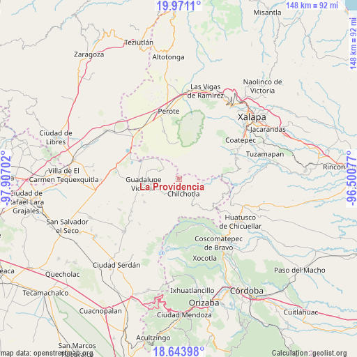
La Providencia GPS coordinates[2]
19° 18' 32.004" North, 97° 12' 14.004" West
| Map corner | latitude | longitude |
|---|---|---|
| Upper-left | 19.9711°, | -97.90702° |
| Center: | 19.30889°, | -97.20389° |
| Lower-right: | 18.64398°, | -96.50077° |
| Map W x H: | 147.6×147.6 km | = 91.7×91.7mi |
| max Lat: | 32.7° ⇑58.6% North |
| La Providencia: | 19.30889° |
| min Lat: | ⇓41.4% South 14.53588° |
| min Long | La Providencia | max Long |
| -117.105° | -97.20389° | -86.73105° |
| W 72.4%⇐ | ⇒27.6% E |
Elevation
Elevation of La Providencia is 2688 m = 8819 ft, and this is 1434.3 m = 4706 ft above average elevation for this country.
| Max E: |
3497 m = 11473 ft | 2.9% |
| La Providencia | 2688 m 8819 ft | |
| Avg. | 1253.7 m = 4113 ft | |
Min E: |
-1 m = -3 ft | 97.1% |
See also: Mexico elevation on elevation.city.
Geographical zone
La Providencia is located in North Torrid zone (between Equator and Tropic of Cancer). Distance of this Northern Tropic circle is 459 km =285.2 mi to North.| Distance of | km | miles | from La Providencia |
|---|---|---|---|
| North Pole | 7860.1 | 4884 | to North |
| Arctic Circle | 5254.2 | 3264.8 | to North |
| Tropic Cancer | 459 | 285.2 | to North |
| Equator | 2146.9 | 1334 | to South |


Nearby cities:
15 places around La Providencia: (largest is in red/bold)
• Acocomotla
3.8 km =2.4 mi,  201°
201°
• Altamirada
6.8 km =4.2 mi,  350°
350°
• Apantéopan
5.6 km =3.5 mi,  13°
13°
• Ayahualulco
7.5 km =4.7 mi,  50°
50°
• El Ciprés
6.8 km =4.2 mi,  357°
357°
• Francisco I. Madero
7 km =4.3 mi, 199°
• Ignacio Zaragoza
3.4 km =2.1 mi,  172°
172°
• La Trinidad
2.8 km =1.7 mi, 201°
• Rafael J. García
6.5 km =4 mi,  160°
160°
• San Antonio
4.6 km =2.9 mi, 157°
• San Antonio Xoquitla
5.4 km =3.4 mi, 49°
• San Isidro
5.9 km =3.7 mi,  29°
29°
• San José Manzanitos
5.4 km =3.4 mi,  192°
192°
• Vicente Guerrero
6 km =3.7 mi,  207°
207°
• Xocotepéc
7.4 km =4.6 mi, 27°
Sources, notices
• [Note1] Compared only with cities in Mexico existing in our database
• [Src1] Map data: © OpenStreetMap contributors (CC-BY-SA)
• [Src2] Other city data from geonames.org with taken over terms of usage.
• [Src3] Geographical zone / Annual Mean Temperature by Robert A. Rohde @ Wikipedia
