El Ciprés geodata
El Ciprés (Veracruz) is a populated place; located in Mexico in America/Mexico_City (GMT-6) time zone. With population of 503 people, there are 16722 cities with bigger population in this country. Compared to other cities in Mexico, 57.1% of cities are located further ↑North; 72.4% of cities are located further ←West and 92.9% of cities have lower elevation than El Ciprés. Note1


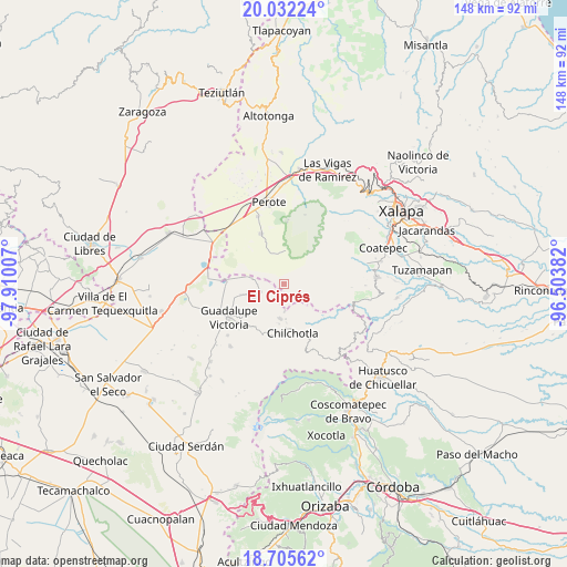
El Ciprés GPS coordinates[2]
19° 22' 13.008" North, 97° 12' 24.984" West
| Map corner | latitude | longitude |
|---|---|---|
| Upper-left | 20.03224°, | -97.91007° |
| Center: | 19.37028°, | -97.20694° |
| Lower-right: | 18.70562°, | -96.50382° |
| Map W x H: | 147.5×147.5 km | = 91.7×91.7mi |
| max Lat: | 32.7° ⇑57.1% North |
| El Ciprés: | 19.37028° |
| min Lat: | ⇓42.9% South 14.53588° |
| min Long | El Ciprés | max Long |
| -117.105° | -97.20694° | -86.73105° |
| W 72.4%⇐ | ⇒27.6% E |
Elevation
Elevation of El Ciprés is 2522 m = 8274 ft, and this is 1268.3 m = 4161 ft above average elevation for this country.
| Max E: |
3497 m = 11473 ft | 7.1% |
| El Ciprés | 2522 m 8274 ft | |
| Avg. | 1253.7 m = 4113 ft | |
Min E: |
-1 m = -3 ft | 92.9% |
See also: Mexico elevation on elevation.city.
Geographical zone
El Ciprés is located in North Torrid zone (between Equator and Tropic of Cancer). Distance of this Northern Tropic circle is 452.1 km =280.9 mi to North.| Distance of | km | miles | from El Ciprés |
|---|---|---|---|
| North Pole | 7853.3 | 4879.8 | to North |
| Arctic Circle | 5247.4 | 3260.6 | to North |
| Tropic Cancer | 452.1 | 280.9 | to North |
| Equator | 2153.8 | 1338.3 | to South |


Nearby cities:
15 places around El Ciprés: (largest is in red/bold)
• Altamirada
0.8 km =0.5 mi,  261°
261°
• Apantéopan
2.1 km =1.3 mi,  128°
128°
• Ayahualulco
6.5 km =4 mi,  109°
109°
• El Progreso
8.8 km =5.5 mi,  280°
280°
• El Triunfo
5.8 km =3.6 mi,  346°
346°
• González Ortega
7.3 km =4.5 mi,  245°
245°
• Ixhuacán de los Reyes
9.5 km =5.9 mi,  100°
100°
• La Gloria
8.4 km =5.2 mi,  289°
289°
• La Providencia
6.8 km =4.2 mi,  177°
177°
• La Toma
9.3 km =5.8 mi,  8°
8°
• La Trinidad
9.4 km =5.8 mi, 184°
• Los Altos
8.5 km =5.3 mi,  3°
3°
• San Antonio Xoquitla
5.5 km =3.4 mi, 126°
• San Isidro
3.7 km =2.3 mi,  117°
117°
• Xocotepéc
3.8 km =2.4 mi,  94°
94°
Sources, notices
• [Note1] Compared only with cities in Mexico existing in our database
• [Src1] Map data: © OpenStreetMap contributors (CC-BY-SA)
• [Src2] Other city data from geonames.org with taken over terms of usage.
• [Src3] Geographical zone / Annual Mean Temperature by Robert A. Rohde @ Wikipedia
