Apantéopan geodata
Apantéopan (Puebla) is a populated place; located in Mexico in America/Mexico_City (GMT-6) time zone. With population of 1,647 people, there are 5269 cities with bigger population in this country. Compared to other cities in Mexico, 57.4% of cities are located further ↑North; 72.6% of cities are located further ←West and 91.1% of cities have lower elevation than Apantéopan. Note1


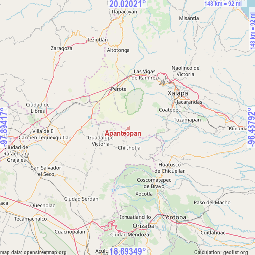
Apantéopan GPS coordinates[2]
19° 21' 29.52" North, 97° 11' 27.744" West
| Map corner | latitude | longitude |
|---|---|---|
| Upper-left | 20.02021°, | -97.89417° |
| Center: | 19.3582°, | -97.19104° |
| Lower-right: | 18.69349°, | -96.48792° |
| Map W x H: | 147.5×147.5 km | = 91.7×91.7mi |
| max Lat: | 32.7° ⇑57.4% North |
| Apantéopan: | 19.3582° |
| min Lat: | ⇓42.6% South 14.53588° |
| min Long | Apantéopan | max Long |
| -117.105° | -97.19104° | -86.73105° |
| W 72.6%⇐ | ⇒27.4% E |
Elevation
Elevation of Apantéopan is 2444 m = 8018 ft, and this is 1190.3 m = 3905 ft above average elevation for this country.
| Max E: |
3497 m = 11473 ft | 8.9% |
| Apantéopan | 2444 m 8018 ft | |
| Avg. | 1253.7 m = 4113 ft | |
Min E: |
-1 m = -3 ft | 91.1% |
See also: Mexico elevation on elevation.city.
Geographical zone
Apantéopan is located in North Torrid zone (between Equator and Tropic of Cancer). Distance of this Northern Tropic circle is 453.5 km =281.8 mi to North.| Distance of | km | miles | from Apantéopan |
|---|---|---|---|
| North Pole | 7854.6 | 4880.6 | to North |
| Arctic Circle | 5248.7 | 3261.4 | to North |
| Tropic Cancer | 453.5 | 281.8 | to North |
| Equator | 2152.4 | 1337.4 | to South |


Nearby cities:
15 places around Apantéopan: (largest is in red/bold)
• Acocomotla
9.4 km =5.8 mi,  197°
197°
• Altamirada
2.8 km =1.7 mi,  296°
296°
• Ayahualulco
4.5 km =2.8 mi,  100°
100°
• El Ciprés
2.1 km =1.3 mi,  308°
308°
• El Triunfo
7.7 km =4.8 mi,  336°
336°
• González Ortega
8.5 km =5.3 mi,  258°
258°
• Ignacio Zaragoza
8.9 km =5.5 mi,  185°
185°
• Ixhuacán de los Reyes
7.7 km =4.8 mi,  92°
92°
• La Providencia
5.6 km =3.5 mi, 193°
• La Trinidad
8.4 km =5.2 mi, 196°
• Los Altos
9.9 km =6.2 mi,  353°
353°
• San Antonio
9.8 km =6.1 mi,  177°
177°
• San Antonio Xoquitla
3.4 km =2.1 mi,  125°
125°
• San Isidro
1.6 km =1 mi, 103°
• Xocotepéc
2.4 km =1.5 mi,  63°
63°
Sources, notices
• [Note1] Compared only with cities in Mexico existing in our database
• [Src1] Map data: © OpenStreetMap contributors (CC-BY-SA)
• [Src2] Other city data from geonames.org with taken over terms of usage.
• [Src3] Geographical zone / Annual Mean Temperature by Robert A. Rohde @ Wikipedia
