El Águila (La Mesa) geodata
El Águila (La Mesa) (State of Mexico) is a populated place; located in Mexico in America/Mexico_City (GMT-6) time zone. With population of 1,413 people, there are 6121 cities with bigger population in this country. Compared to other cities in Mexico, 61.8% of cities are located further ↑North; 55.7% of cities are located further →East and 98.8% of cities have lower elevation than El Águila (La Mesa). Note1


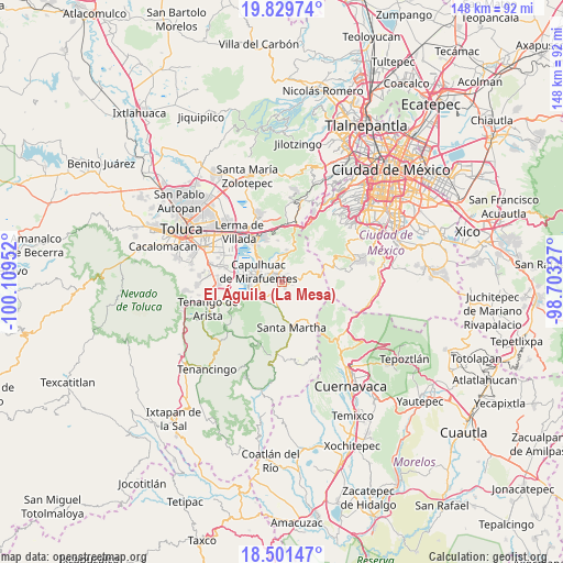
El Águila (La Mesa) GPS coordinates[2]
19° 10' 0.984" North, 99° 24' 23.004" West
| Map corner | latitude | longitude |
|---|---|---|
| Upper-left | 19.82974°, | -100.10952° |
| Center: | 19.16694°, | -99.40639° |
| Lower-right: | 18.50147°, | -98.70327° |
| Map W x H: | 147.7×147.7 km | = 91.8×91.8mi |
| max Lat: | 32.7° ⇑61.8% North |
| El Águila (La Mesa): | 19.16694° |
| min Lat: | ⇓38.2% South 14.53588° |
| min Long | El Águila (La | max Long |
| -117.105° | -99.40639° | -86.73105° |
| W 44.3%⇐ | ⇒55.7% E |
Elevation
Elevation of El Águila (La Mesa) is 2818 m = 9245 ft, and this is 1564.3 m = 5132 ft above average elevation for this country.
| Max E: |
3497 m = 11473 ft | 1.2% |
| El Águila (La Mesa) | 2818 m 9245 ft | |
| Avg. | 1253.7 m = 4113 ft | |
Min E: |
-1 m = -3 ft | 98.8% |
See also: Mexico elevation on elevation.city.
Geographical zone
El Águila (La Mesa) is located in North Torrid zone (between Equator and Tropic of Cancer). Distance of this Northern Tropic circle is 474.8 km =295 mi to North.| Distance of | km | miles | from El Águila (La Mesa) |
|---|---|---|---|
| North Pole | 7875.9 | 4893.9 | to North |
| Arctic Circle | 5270 | 3274.6 | to North |
| Tropic Cancer | 474.8 | 295 | to North |
| Equator | 2131.2 | 1324.3 | to South |


Nearby cities:
15 places around El Águila (La Mesa): (largest is in red/bold)
• Chiquixpac Sección II
3.2 km =2 mi,  184°
184°
• Coexapa
1.4 km =0.9 mi,  145°
145°
• Cruz Larga
1.2 km =0.7 mi,  37°
37°
• Cuixapa (Coexapa)
1.1 km =0.7 mi,  143°
143°
• El Potrero
1.9 km =1.2 mi,  9°
9°
• La Magdalena de los Reyes (La Magdalena)
2.6 km =1.6 mi,  351°
351°
• Los Tejocotes
1.9 km =1.2 mi,  23°
23°
• Pueblo Nuevo
3.6 km =2.2 mi,  215°
215°
• San Juan Tomasquillo Herradura
0.6 km =0.4 mi, 24°
• San Nicolás Coatepec
4.1 km =2.5 mi, 216°
• Santa Cruz de Bravo (Santa Cruz)
3.8 km =2.4 mi, 350°
• Santiago Tílapa
2.9 km =1.8 mi,  328°
328°
• Techichili
1.7 km =1.1 mi,  286°
286°
• Techmaninalli
3.3 km =2.1 mi,  204°
204°
• Xalatlaco
2.2 km =1.4 mi,  324°
324°
Sources, notices
• [Note1] Compared only with cities in Mexico existing in our database
• [Src1] Map data: © OpenStreetMap contributors (CC-BY-SA)
• [Src2] Other city data from geonames.org with taken over terms of usage.
• [Src3] Geographical zone / Annual Mean Temperature by Robert A. Rohde @ Wikipedia
