Cuixapa (Coexapa) geodata
Cuixapa (Coexapa) (State of Mexico) is a populated place; located in Mexico in America/Mexico_City (GMT-6) time zone. With population of 980 people, there are 8875 cities with bigger population in this country. Compared to other cities in Mexico, 62% of cities are located further ↑North; 55.6% of cities are located further →East and 99.1% of cities have lower elevation than Cuixapa (Coexapa). Note1


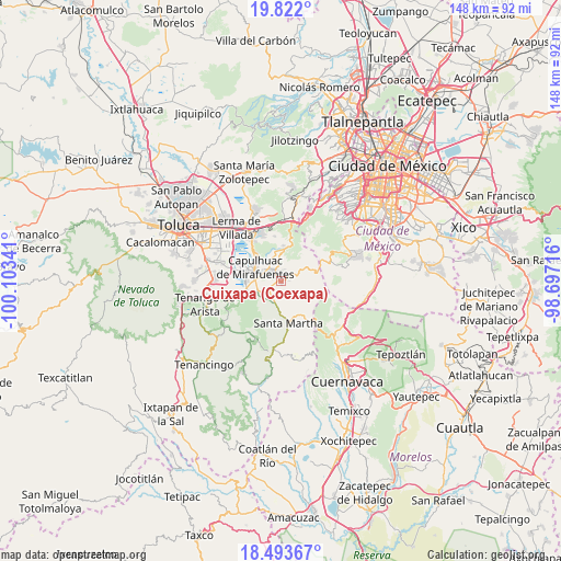
Cuixapa (Coexapa) GPS coordinates[2]
19° 9' 33.012" North, 99° 24' 1.008" West
| Map corner | latitude | longitude |
|---|---|---|
| Upper-left | 19.822°, | -100.10341° |
| Center: | 19.15917°, | -99.40028° |
| Lower-right: | 18.49367°, | -98.69716° |
| Map W x H: | 147.7×147.7 km | = 91.8×91.8mi |
| max Lat: | 32.7° ⇑62% North |
| Cuixapa (Coexapa): | 19.15917° |
| min Lat: | ⇓38% South 14.53588° |
| min Long | Cuixapa (Coexap | max Long |
| -117.105° | -99.40028° | -86.73105° |
| W 44.4%⇐ | ⇒55.6% E |
Elevation
Elevation of Cuixapa (Coexapa) is 2855 m = 9367 ft, and this is 1601.3 m = 5254 ft above average elevation for this country.
| Max E: |
3497 m = 11473 ft | 0.90000000000001% |
| Cuixapa (Coexapa) | 2855 m 9367 ft | |
| Avg. | 1253.7 m = 4113 ft | |
Min E: |
-1 m = -3 ft | 99.1% |
See also: Mexico elevation on elevation.city.
Geographical zone
Cuixapa (Coexapa) is located in North Torrid zone (between Equator and Tropic of Cancer). Distance of this Northern Tropic circle is 475.6 km =295.5 mi to North.| Distance of | km | miles | from Cuixapa (Coexapa) |
|---|---|---|---|
| North Pole | 7876.8 | 4894.4 | to North |
| Arctic Circle | 5270.9 | 3275.2 | to North |
| Tropic Cancer | 475.6 | 295.5 | to North |
| Equator | 2130.3 | 1323.7 | to South |


Nearby cities:
15 places around Cuixapa (Coexapa): (largest is in red/bold)
• Chiquixpac Sección II
2.5 km =1.6 mi,  200°
200°
• Coexapa
0.4 km =0.2 mi,  152°
152°
• Cruz Larga
1.9 km =1.2 mi,  3°
3°
• El Potrero
2.7 km =1.7 mi,  353°
353°
• El Águila (La Mesa)
1.1 km =0.7 mi,  323°
323°
• La Magdalena de los Reyes (La Magdalena)
3.5 km =2.2 mi,  343°
343°
• Los Tejocotes
2.6 km =1.6 mi, 2°
• Metztitla
4.3 km =2.7 mi,  213°
213°
• Pueblo Nuevo
3.4 km =2.1 mi,  233°
233°
• San Juan Tomasquillo Herradura
1.5 km =0.9 mi, 345°
• San Nicolás Coatepec
3.9 km =2.4 mi, 231°
• Santiago Tílapa
4 km =2.5 mi,  327°
327°
• Techichili
2.7 km =1.7 mi,  300°
300°
• Techmaninalli
2.9 km =1.8 mi,  223°
223°
• Xalatlaco
3.3 km =2.1 mi, 324°
Sources, notices
• [Note1] Compared only with cities in Mexico existing in our database
• [Src1] Map data: © OpenStreetMap contributors (CC-BY-SA)
• [Src2] Other city data from geonames.org with taken over terms of usage.
• [Src3] Geographical zone / Annual Mean Temperature by Robert A. Rohde @ Wikipedia
