Arroyo Frijol geodata
Arroyo Frijol (Oaxaca) is a populated place; located in Mexico in America/Mexico_City (GMT-6) time zone. With population of 639 people, there are 13559 cities with bigger population in this country. Compared to other cities in Mexico, 79.4% of cities are located further ↑North; 81.5% of cities are located further ←West and 81.6% of cities have higher elevation than Arroyo Frijol. Note1


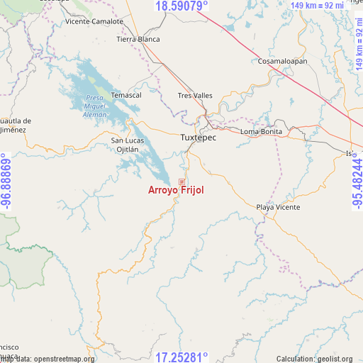
Arroyo Frijol GPS coordinates[2]
17° 55' 23.016" North, 96° 11' 8.016" West
| Map corner | latitude | longitude |
|---|---|---|
| Upper-left | 18.59079°, | -96.88869° |
| Center: | 17.92306°, | -96.18556° |
| Lower-right: | 17.25281°, | -95.48244° |
| Map W x H: | 148.8×148.8 km | = 92.5×92.5mi |
| max Lat: | 32.7° ⇑79.4% North |
| Arroyo Frijol: | 17.92306° |
| min Lat: | ⇓20.6% South 14.53588° |
| min Long | Arroyo Frijol | max Long |
| -117.105° | -96.18556° | -86.73105° |
| W 81.5%⇐ | ⇒18.5% E |
Elevation
Elevation of Arroyo Frijol is 74 m = 243 ft, and this is 1179.7 m = 3870 ft below average elevation for this country.
| Max E: |
3497 m = 11473 ft | 81.6% |
| Avg. | 1253.7 m = 4113 ft | |
| Arroyo Frijol | 74 m = 243 ft | |
Min E: |
-1 m = -3 ft | 18.4% |
See also: Mexico elevation on elevation.city.
Geographical zone
Arroyo Frijol is located in North Torrid zone (between Equator and Tropic of Cancer). Distance of this Northern Tropic circle is 613.1 km =381 mi to North.| Distance of | km | miles | from Arroyo Frijol |
|---|---|---|---|
| North Pole | 8014.2 | 4979.8 | to North |
| Arctic Circle | 5408.3 | 3360.6 | to North |
| Tropic Cancer | 613.1 | 381 | to North |
| Equator | 1992.9 | 1238.3 | to South |


Nearby cities:
15 places around Arroyo Frijol: (largest is in red/bold)
• Arroyo Choápam
6 km =3.7 mi,  29°
29°
• Camelia Roja
11.9 km =7.4 mi,  348°
348°
• Cerro Concha
9.9 km =6.2 mi,  183°
183°
• Fortino J. Pinacho
7.6 km =4.7 mi,  9°
9°
• La Mina
11.5 km =7.1 mi,  51°
51°
• La Reforma
12.3 km =7.6 mi,  77°
77°
• Paso Canoa
11.4 km =7.1 mi,  330°
330°
• Rodeo Arroyo Pepesca
12.1 km =7.5 mi,  69°
69°
• San Isidro Chinantilla
13 km =8.1 mi,  205°
205°
• San Isidro Naranjal
7.3 km =4.5 mi,  121°
121°
• San José Chiltepec
3.2 km =2 mi, 32°
• Santa María Jacatepec
7.5 km =4.7 mi,  201°
201°
• Santa Ursula
10.7 km =6.6 mi, 330°
• Sebastopol
12.3 km =7.6 mi, 6°
• Vega del Sol
13 km =8.1 mi,  194°
194°
Sources, notices
• [Note1] Compared only with cities in Mexico existing in our database
• [Src1] Map data: © OpenStreetMap contributors (CC-BY-SA)
• [Src2] Other city data from geonames.org with taken over terms of usage.
• [Src3] Geographical zone / Annual Mean Temperature by Robert A. Rohde @ Wikipedia
