San Carlos Autopan geodata
San Carlos Autopan (State of Mexico) is a populated place; located in Mexico in America/Mexico_City (GMT-6) time zone. With population of 1,202 people, there are 7230 cities with bigger population in this country. Compared to other cities in Mexico, 56.6% of cities are located further ↑North; 60.1% of cities are located further →East and 95.7% of cities have lower elevation than San Carlos Autopan. Note1


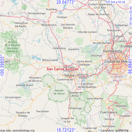
San Carlos Autopan GPS coordinates[2]
19° 23' 8.988" North, 99° 41' 13.992" West
| Map corner | latitude | longitude |
|---|---|---|
| Upper-left | 20.04773°, | -100.39035° |
| Center: | 19.38583°, | -99.68722° |
| Lower-right: | 18.72123°, | -98.9841° |
| Map W x H: | 147.5×147.5 km | = 91.7×91.7mi |
| max Lat: | 32.7° ⇑56.6% North |
| San Carlos Autopan: | 19.38583° |
| min Lat: | ⇓43.4% South 14.53588° |
| min Long | San Carlos Auto | max Long |
| -117.105° | -99.68722° | -86.73105° |
| W 39.9%⇐ | ⇒60.1% E |
Elevation
Elevation of San Carlos Autopan is 2614 m = 8576 ft, and this is 1360.3 m = 4463 ft above average elevation for this country.
| Max E: |
3497 m = 11473 ft | 4.3% |
| San Carlos Autopan | 2614 m 8576 ft | |
| Avg. | 1253.7 m = 4113 ft | |
Min E: |
-1 m = -3 ft | 95.7% |
See also: Mexico elevation on elevation.city.
Geographical zone
San Carlos Autopan is located in North Torrid zone (between Equator and Tropic of Cancer). Distance of this Northern Tropic circle is 450.4 km =279.9 mi to North.| Distance of | km | miles | from San Carlos Autopan |
|---|---|---|---|
| North Pole | 7851.6 | 4878.8 | to North |
| Arctic Circle | 5245.7 | 3259.5 | to North |
| Tropic Cancer | 450.4 | 279.9 | to North |
| Equator | 2155.5 | 1339.4 | to South |


Nearby cities:
15 places around San Carlos Autopan: (largest is in red/bold)
• Barrio Bordo Nuevo
1.6 km =1 mi,  116°
116°
• Barrio Santa Cruz
4.6 km =2.9 mi,  146°
146°
• Barrio de Jesús Fracción Primera
2 km =1.2 mi,  179°
179°
• Barrio del Cajón
3.1 km =1.9 mi,  78°
78°
• Colonia Aviación Autopan
0.9 km =0.6 mi,  218°
218°
• Ejido San Marcos Yachihuacaltepec
3.3 km =2.1 mi,  254°
254°
• Fraccionamiento Real de San Pablo
4.1 km =2.5 mi, 84°
• Galaxias Toluca
4.1 km =2.5 mi,  70°
70°
• La Loma Cuexcontitlán
4.1 km =2.5 mi,  99°
99°
• Mina México
5 km =3.1 mi,  302°
302°
• Ojo de Agua Autopan
2.8 km =1.7 mi,  189°
189°
• Palmillas
4.3 km =2.7 mi,  174°
174°
• San Martín Toltepec
4.2 km =2.6 mi,  207°
207°
• San Pablo Autopan
4.5 km =2.8 mi,  136°
136°
• Sebastián Lerdo de Tejada
4 km =2.5 mi,  276°
276°
Sources, notices
• [Note1] Compared only with cities in Mexico existing in our database
• [Src1] Map data: © OpenStreetMap contributors (CC-BY-SA)
• [Src2] Other city data from geonames.org with taken over terms of usage.
• [Src3] Geographical zone / Annual Mean Temperature by Robert A. Rohde @ Wikipedia
