Macutzio geodata
Macutzio (Michoacán) is a populated place; located in Mexico in America/Mexico_City (GMT-6) time zone. With population of 1,191 people, there are 7293 cities with bigger population in this country. Compared to other cities in Mexico, 54% of cities are located further ↑North; 68% of cities are located further →East and 72.7% of cities have lower elevation than Macutzio. Note1


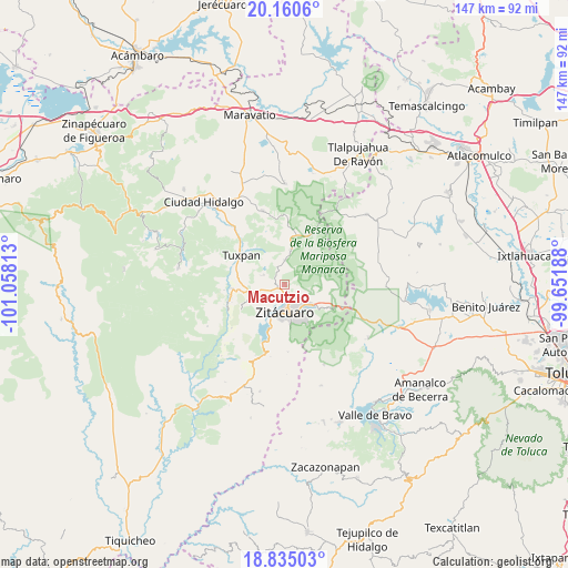
Macutzio GPS coordinates[2]
19° 29' 57.012" North, 100° 21' 18" West
| Map corner | latitude | longitude |
|---|---|---|
| Upper-left | 20.1606°, | -101.05813° |
| Center: | 19.49917°, | -100.355° |
| Lower-right: | 18.83503°, | -99.65188° |
| Map W x H: | 147.4×147.4 km | = 91.6×91.6mi |
| max Lat: | 32.7° ⇑54% North |
| Macutzio: | 19.49917° |
| min Lat: | ⇓46% South 14.53588° |
| min Long | Macutzio | max Long |
| -117.105° | -100.355° | -86.73105° |
| W 32%⇐ | ⇒68% E |
Elevation
Elevation of Macutzio is 1983 m = 6506 ft, and this is 729.3 m = 2393 ft above average elevation for this country.
| Max E: |
3497 m = 11473 ft | 27.3% |
| Macutzio | 1983 m 6506 ft | |
| Avg. | 1253.7 m = 4113 ft | |
Min E: |
-1 m = -3 ft | 72.7% |
See also: Mexico elevation on elevation.city.
Geographical zone
Macutzio is located in North Torrid zone (between Equator and Tropic of Cancer). Distance of this Northern Tropic circle is 437.8 km =272 mi to North.| Distance of | km | miles | from Macutzio |
|---|---|---|---|
| North Pole | 7839 | 4870.9 | to North |
| Arctic Circle | 5233.1 | 3251.7 | to North |
| Tropic Cancer | 437.8 | 272 | to North |
| Equator | 2168.1 | 1347.2 | to South |


Nearby cities:
15 places around Macutzio: (largest is in red/bold)
• Carpinteros
4.2 km =2.6 mi,  104°
104°
• Curungueo
4 km =2.5 mi,  162°
162°
• El Rincón de San Felipe (Tercera Manzana San Felipe)
2 km =1.2 mi,  293°
293°
• La Manzana de Santa Cruz
4.7 km =2.9 mi,  351°
351°
• La Mesa (La Mesa de Cedano)
6.3 km =3.9 mi,  152°
152°
• La Presa (Segunda Manzana Barrio de Santa Cruz)
6.4 km =4 mi,  300°
300°
• Loma Larga
4.7 km =2.9 mi,  188°
188°
• Manzana la Cofradía
5.6 km =3.5 mi,  359°
359°
• Mesa de los Alzati (Mesa de San Felipe)
3.6 km =2.2 mi,  270°
270°
• Puentecillas (Tercera Manzana de Zirahuato)
5.3 km =3.3 mi,  277°
277°
• Puerto Azul (Quinta Manzana de San Felipe)
4.9 km =3 mi,  243°
243°
• Rincón de Curungueo
2.1 km =1.3 mi, 147°
• San Felipe los Alzati (Colonia Nueva)
2.2 km =1.4 mi, 242°
• Valle Verde
3 km =1.9 mi,  180°
180°
• Zirahuato de los Bernal
5.9 km =3.7 mi, 294°
Sources, notices
• [Note1] Compared only with cities in Mexico existing in our database
• [Src1] Map data: © OpenStreetMap contributors (CC-BY-SA)
• [Src2] Other city data from geonames.org with taken over terms of usage.
• [Src3] Geographical zone / Annual Mean Temperature by Robert A. Rohde @ Wikipedia
