Loma Larga geodata
Loma Larga (Michoacán) is a populated place; located in Mexico in America/Mexico_City (GMT-6) time zone. With population of 569 people, there are 15027 cities with bigger population in this country. Compared to other cities in Mexico, 54.9% of cities are located further ↑North; 68% of cities are located further →East and 68.5% of cities have lower elevation than Loma Larga. Note1


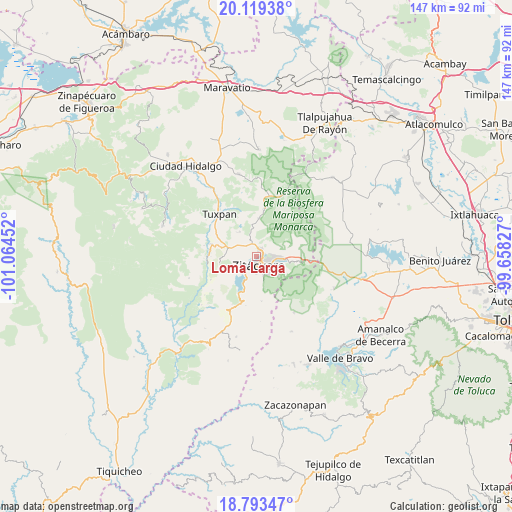
Loma Larga GPS coordinates[2]
19° 27' 28.008" North, 100° 21' 41.004" West
| Map corner | latitude | longitude |
|---|---|---|
| Upper-left | 20.11938°, | -101.06452° |
| Center: | 19.45778°, | -100.36139° |
| Lower-right: | 18.79347°, | -99.65827° |
| Map W x H: | 147.4×147.4 km | = 91.6×91.6mi |
| max Lat: | 32.7° ⇑54.9% North |
| Loma Larga: | 19.45778° |
| min Lat: | ⇓45.1% South 14.53588° |
| min Long | Loma Larga | max Long |
| -117.105° | -100.36139° | -86.73105° |
| W 32%⇐ | ⇒68% E |
Elevation
Elevation of Loma Larga is 1898 m = 6227 ft, and this is 644.3 m = 2114 ft above average elevation for this country.
| Max E: |
3497 m = 11473 ft | 31.5% |
| Loma Larga | 1898 m 6227 ft | |
| Avg. | 1253.7 m = 4113 ft | |
Min E: |
-1 m = -3 ft | 68.5% |
See also: Mexico elevation on elevation.city.
Geographical zone
Loma Larga is located in North Torrid zone (between Equator and Tropic of Cancer). Distance of this Northern Tropic circle is 442.4 km =274.9 mi to North.| Distance of | km | miles | from Loma Larga |
|---|---|---|---|
| North Pole | 7843.6 | 4873.8 | to North |
| Arctic Circle | 5237.7 | 3254.6 | to North |
| Tropic Cancer | 442.4 | 274.9 | to North |
| Equator | 2163.5 | 1344.3 | to South |


Nearby cities:
15 places around Loma Larga: (largest is in red/bold)
• Camémbaro
5.2 km =3.2 mi,  229°
229°
• Carpinteros
5.9 km =3.7 mi,  52°
52°
• Colonia Emiliano Zapata (San Juan Zitácuaro)
5.9 km =3.7 mi,  100°
100°
• Curungueo
2 km =1.2 mi,  68°
68°
• El Rincón de San Felipe (Tercera Manzana San Felipe)
5.5 km =3.4 mi,  347°
347°
• Heróica Zitácuaro
2.4 km =1.5 mi,  169°
169°
• La Encarnación
6 km =3.7 mi,  212°
212°
• La Fundición (Quinta Manzana)
6.1 km =3.8 mi,  92°
92°
• La Mesa (La Mesa de Cedano)
3.7 km =2.3 mi,  105°
105°
• Macutzio
4.7 km =2.9 mi,  8°
8°
• Mesa de los Alzati (Mesa de San Felipe)
5.5 km =3.4 mi,  327°
327°
• Puerto Azul (Quinta Manzana de San Felipe)
4.5 km =2.8 mi,  302°
302°
• Rincón de Curungueo
3.4 km =2.1 mi,  32°
32°
• San Felipe los Alzati (Colonia Nueva)
3.8 km =2.4 mi,  339°
339°
• Valle Verde
1.8 km =1.1 mi,  21°
21°
Sources, notices
• [Note1] Compared only with cities in Mexico existing in our database
• [Src1] Map data: © OpenStreetMap contributors (CC-BY-SA)
• [Src2] Other city data from geonames.org with taken over terms of usage.
• [Src3] Geographical zone / Annual Mean Temperature by Robert A. Rohde @ Wikipedia
