Santa María Xigui geodata
Santa María Xigui (Hidalgo) is a populated place; located in Mexico in America/Mexico_City (GMT-6) time zone. With population of 1,104 people, there are 7876 cities with bigger population in this country. Compared to other cities in Mexico, 66.9% of cities are located further ↓South; 54.8% of cities are located further →East and 66% of cities have lower elevation than Santa María Xigui. Note1


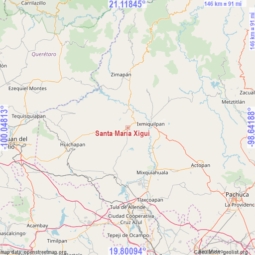
Santa María Xigui GPS coordinates[2]
20° 27' 39.996" North, 99° 20' 42" West
| Map corner | latitude | longitude |
|---|---|---|
| Upper-left | 21.11845°, | -100.04813° |
| Center: | 20.46111°, | -99.345° |
| Lower-right: | 19.80094°, | -98.64188° |
| Map W x H: | 146.5×146.5 km | = 91×91mi |
| max Lat: | 32.7° ⇑33.1% North |
| Santa María Xigui: | 20.46111° |
| min Lat: | ⇓66.9% South 14.53588° |
| min Long | Santa María Xi | max Long |
| -117.105° | -99.345° | -86.73105° |
| W 45.2%⇐ | ⇒54.8% E |
Elevation
Elevation of Santa María Xigui is 1852 m = 6076 ft, and this is 598.3 m = 1963 ft above average elevation for this country.
| Max E: |
3497 m = 11473 ft | 34% |
| Santa María Xigui | 1852 m 6076 ft | |
| Avg. | 1253.7 m = 4113 ft | |
Min E: |
-1 m = -3 ft | 66% |
See also: Mexico elevation on elevation.city.
Geographical zone
Santa María Xigui is located in North Torrid zone (between Equator and Tropic of Cancer). Distance of this Northern Tropic circle is 330.9 km =205.6 mi to North.| Distance of | km | miles | from Santa María Xigui |
|---|---|---|---|
| North Pole | 7732 | 4804.4 | to North |
| Arctic Circle | 5126.1 | 3185.2 | to North |
| Tropic Cancer | 330.9 | 205.6 | to North |
| Equator | 2275.1 | 1413.7 | to South |


Nearby cities:
15 places around Santa María Xigui: (largest is in red/bold)
• Alfajayucan
5.9 km =3.7 mi,  183°
183°
• Boxtho
7.9 km =4.9 mi,  197°
197°
• Caltimacan
8.8 km =5.5 mi,  342°
342°
• Danghu
5 km =3.1 mi,  356°
356°
• El Deca
7.1 km =4.4 mi,  75°
75°
• El Déxtho
9.3 km =5.8 mi,  59°
59°
• El Espíritu
4.7 km =2.9 mi, 199°
• Ignacio López Rayón
8.2 km =5.1 mi,  70°
70°
• La Huapilla
5.2 km =3.2 mi,  213°
213°
• La Vega
3.7 km =2.3 mi,  25°
25°
• Panales
8.2 km =5.1 mi, 83°
• Portezuelo
5 km =3.1 mi,  54°
54°
• Santiago Ixtlahuaca
4.9 km =3 mi, 30°
• Yonthe Chico
6.1 km =3.8 mi,  162°
162°
• Zocea
2.9 km =1.8 mi, 206°
Sources, notices
• [Note1] Compared only with cities in Mexico existing in our database
• [Src1] Map data: © OpenStreetMap contributors (CC-BY-SA)
• [Src2] Other city data from geonames.org with taken over terms of usage.
• [Src3] Geographical zone / Annual Mean Temperature by Robert A. Rohde @ Wikipedia
