Santiago Ixtlahuaca geodata
Santiago Ixtlahuaca (Hidalgo) is a populated place; located in Mexico in America/Mexico_City (GMT-6) time zone. With population of 873 people, there are 10005 cities with bigger population in this country. Compared to other cities in Mexico, 67.8% of cities are located further ↓South; 54.4% of cities are located further →East and 65.2% of cities have lower elevation than Santiago Ixtlahuaca. Note1


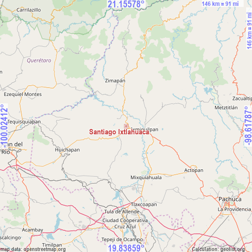
Santiago Ixtlahuaca GPS coordinates[2]
20° 29' 54.96" North, 99° 19' 15.564" West
| Map corner | latitude | longitude |
|---|---|---|
| Upper-left | 21.15578°, | -100.02412° |
| Center: | 20.4986°, | -99.32099° |
| Lower-right: | 19.83859°, | -98.61787° |
| Map W x H: | 146.5×146.5 km | = 91×91mi |
| max Lat: | 32.7° ⇑32.2% North |
| Santiago Ixtlahuaca: | 20.4986° |
| min Lat: | ⇓67.8% South 14.53588° |
| min Long | Santiago Ixtlah | max Long |
| -117.105° | -99.32099° | -86.73105° |
| W 45.6%⇐ | ⇒54.4% E |
Elevation
Elevation of Santiago Ixtlahuaca is 1834 m = 6017 ft, and this is 580.3 m = 1904 ft above average elevation for this country.
| Max E: |
3497 m = 11473 ft | 34.8% |
| Santiago Ixtlahuaca | 1834 m 6017 ft | |
| Avg. | 1253.7 m = 4113 ft | |
Min E: |
-1 m = -3 ft | 65.2% |
See also: Mexico elevation on elevation.city.
Geographical zone
Santiago Ixtlahuaca is located in North Torrid zone (between Equator and Tropic of Cancer). Distance of this Northern Tropic circle is 326.7 km =203 mi to North.| Distance of | km | miles | from Santiago Ixtlahuaca |
|---|---|---|---|
| North Pole | 7727.8 | 4801.8 | to North |
| Arctic Circle | 5121.9 | 3182.6 | to North |
| Tropic Cancer | 326.7 | 203 | to North |
| Equator | 2279.2 | 1416.2 | to South |


Nearby cities:
15 places around Santiago Ixtlahuaca: (largest is in red/bold)
• Arbolado
7.2 km =4.5 mi,  357°
357°
• Bondhí
4.6 km =2.9 mi,  35°
35°
• Caltimacan
6.6 km =4.1 mi,  309°
309°
• Danghu
3 km =1.9 mi,  286°
286°
• El Deca
5 km =3.1 mi,  118°
118°
• El Déxtho
5.5 km =3.4 mi,  83°
83°
• Ignacio López Rayón
5.5 km =3.4 mi,  105°
105°
• Juchitlán
6.5 km =4 mi,  32°
32°
• La Candelaria
7.6 km =4.7 mi,  9°
9°
• La Vega
1.2 km =0.7 mi,  227°
227°
• Panales
6.5 km =4 mi, 119°
• Portezuelo
2 km =1.2 mi,  130°
130°
• San Isidro
5.3 km =3.3 mi, 357°
• Santa María Xigui
4.9 km =3 mi,  210°
210°
• Tasquillo
5.6 km =3.5 mi, 8°
Sources, notices
• [Note1] Compared only with cities in Mexico existing in our database
• [Src1] Map data: © OpenStreetMap contributors (CC-BY-SA)
• [Src2] Other city data from geonames.org with taken over terms of usage.
• [Src3] Geographical zone / Annual Mean Temperature by Robert A. Rohde @ Wikipedia
