Chiquinival geodata
Chiquinival (Chiapas) is a populated place; located in Mexico in America/Mexico_City (GMT-6) time zone. With population of 1,101 people, there are 7901 cities with bigger population in this country. Compared to other cities in Mexico, 89% of cities are located further ↑North; 95.5% of cities are located further ←West and 56.2% of cities have higher elevation than Chiquinival. Note1


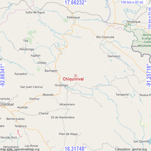
Chiquinival GPS coordinates[2]
16° 59' 27.996" North, 91° 57' 37.008" West
| Map corner | latitude | longitude |
|---|---|---|
| Upper-left | 17.66232°, | -92.66341° |
| Center: | 16.99111°, | -91.96028° |
| Lower-right: | 16.31748°, | -91.25716° |
| Map W x H: | 149.5×149.5 km | = 92.9×92.9mi |
| max Lat: | 32.7° ⇑89% North |
| Chiquinival: | 16.99111° |
| min Lat: | ⇓11% South 14.53588° |
| min Long | Chiquinival | max Long |
| -117.105° | -91.96028° | -86.73105° |
| W 95.5%⇐ | ⇒4.5% E |
Elevation
Elevation of Chiquinival is 1150 m = 3773 ft, and this is 103.7 m = 340 ft below average elevation for this country.
| Max E: |
3497 m = 11473 ft | 56.2% |
| Avg. | 1253.7 m = 4113 ft | |
| Chiquinival | 1150 m = 3773 ft | |
Min E: |
-1 m = -3 ft | 43.8% |
See also: Mexico elevation on elevation.city.
Geographical zone
Chiquinival is located in North Torrid zone (between Equator and Tropic of Cancer). Distance of this Northern Tropic circle is 716.7 km =445.3 mi to North.| Distance of | km | miles | from Chiquinival |
|---|---|---|---|
| North Pole | 8117.8 | 5044.2 | to North |
| Arctic Circle | 5511.9 | 3424.9 | to North |
| Tropic Cancer | 716.7 | 445.3 | to North |
| Equator | 1889.2 | 1173.9 | to South |


Nearby cities:
15 places around Chiquinival: (largest is in red/bold)
• El Carmen
8.6 km =5.3 mi,  286°
286°
• Guadalupe Paxiljá
16.3 km =10.1 mi,  332°
332°
• Jet-Já
9.2 km =5.7 mi,  21°
21°
• Jol Hic'Batil
16.8 km =10.4 mi,  341°
341°
• Jol Sacún
17.4 km =10.8 mi,  38°
38°
• La Reforma
7.4 km =4.6 mi,  120°
120°
• Nazaret
5.2 km =3.2 mi,  105°
105°
• Nuevo Jerusalén
12.7 km =7.9 mi,  213°
213°
• Nuevo Paraíso
16.4 km =10.2 mi,  226°
226°
• Ocosingo
17 km =10.6 mi,  236°
236°
• Sacún Cubwitz
15.5 km =9.6 mi,  7°
7°
• San Antonio las Delicias (Pamala)
14.9 km =9.3 mi,  142°
142°
• San Salvador
9.2 km =5.7 mi,  103°
103°
• Santiago Pojcol
2.2 km =1.4 mi,  271°
271°
• Tzobojitle Jotoaquil
11.2 km =7 mi,  279°
279°
Sources, notices
• [Note1] Compared only with cities in Mexico existing in our database
• [Src1] Map data: © OpenStreetMap contributors (CC-BY-SA)
• [Src2] Other city data from geonames.org with taken over terms of usage.
• [Src3] Geographical zone / Annual Mean Temperature by Robert A. Rohde @ Wikipedia
