Fuerte de Guadalupe geodata
Fuerte de Guadalupe (Puebla) is a populated place; located in Mexico in America/Mexico_City (GMT-6) time zone. With population of 979 people, there are 8884 cities with bigger population in this country. Compared to other cities in Mexico, 63.4% of cities are located further ↑North; 60% of cities are located further ←West and 80.7% of cities have lower elevation than Fuerte de Guadalupe. Note1


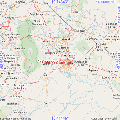
Fuerte de Guadalupe GPS coordinates[2]
19° 4' 49.008" North, 98° 17' 29.004" West
| Map corner | latitude | longitude |
|---|---|---|
| Upper-left | 19.74343°, | -98.99452° |
| Center: | 19.08028°, | -98.29139° |
| Lower-right: | 18.41446°, | -97.58827° |
| Map W x H: | 147.8×147.8 km | = 91.8×91.8mi |
| max Lat: | 32.7° ⇑63.4% North |
| Fuerte de Guadalupe: | 19.08028° |
| min Lat: | ⇓36.6% South 14.53588° |
| min Long | Fuerte de Guada | max Long |
| -117.105° | -98.29139° | -86.73105° |
| W 60%⇐ | ⇒40% E |
Elevation
Elevation of Fuerte de Guadalupe is 2158 m = 7080 ft, and this is 904.3 m = 2967 ft above average elevation for this country.
| Max E: |
3497 m = 11473 ft | 19.3% |
| Fuerte de Guadalupe | 2158 m 7080 ft | |
| Avg. | 1253.7 m = 4113 ft | |
Min E: |
-1 m = -3 ft | 80.7% |
See also: Mexico elevation on elevation.city.
Geographical zone
Fuerte de Guadalupe is located in North Torrid zone (between Equator and Tropic of Cancer). Distance of this Northern Tropic circle is 484.4 km =301 mi to North.| Distance of | km | miles | from Fuerte de Guadalupe |
|---|---|---|---|
| North Pole | 7885.5 | 4899.8 | to North |
| Arctic Circle | 5279.6 | 3280.6 | to North |
| Tropic Cancer | 484.4 | 301 | to North |
| Equator | 2121.5 | 1318.2 | to South |


Nearby cities:
15 places around Fuerte de Guadalupe: (largest is in red/bold)
• Barrio de Nuevo León
0.9 km =0.6 mi,  8°
8°
• Cholula
2.2 km =1.4 mi,  215°
215°
• Coronango
4.8 km =3 mi,  341°
341°
• Cuanalá
5 km =3.1 mi,  309°
309°
• Cuautlancingo
2.2 km =1.4 mi,  60°
60°
• La Trinidad Chautenco
3.1 km =1.9 mi,  69°
69°
• San Andrés Cholula
3.2 km =2 mi,  187°
187°
• San Bernardino Tlaxcalancingo
5.9 km =3.7 mi,  165°
165°
• San Diego los Sauces
0.3 km =0.2 mi,  264°
264°
• San Francisco Cuapa
7.9 km =4.9 mi, 260°
• San Francisco Ocotlán
6 km =3.7 mi, 7°
• San Luis Tehuiloyocan
6.7 km =4.2 mi,  226°
226°
• Sanctorum
4.4 km =2.7 mi, 61°
• Santiago Momoxpan
2.7 km =1.7 mi,  106°
106°
• Zacapechpan
6.9 km =4.3 mi,  245°
245°
Sources, notices
• [Note1] Compared only with cities in Mexico existing in our database
• [Src1] Map data: © OpenStreetMap contributors (CC-BY-SA)
• [Src2] Other city data from geonames.org with taken over terms of usage.
• [Src3] Geographical zone / Annual Mean Temperature by Robert A. Rohde @ Wikipedia
