Zacapechpan geodata
Zacapechpan (Puebla) is a populated place; located in Mexico in America/Mexico_City (GMT-6) time zone. With population of 6,959 people, there are 1335 cities with bigger population in this country. Compared to other cities in Mexico, 63.8% of cities are located further ↑North; 59.2% of cities are located further ←West and 81.5% of cities have lower elevation than Zacapechpan. Note1


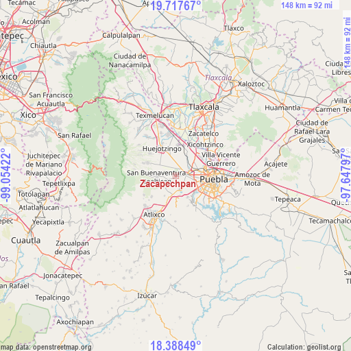
Zacapechpan GPS coordinates[2]
19° 3' 15.876" North, 98° 21' 3.924" West
| Map corner | latitude | longitude |
|---|---|---|
| Upper-left | 19.71767°, | -99.05422° |
| Center: | 19.05441°, | -98.35109° |
| Lower-right: | 18.38849°, | -97.64797° |
| Map W x H: | 147.8×147.8 km | = 91.8×91.8mi |
| max Lat: | 32.7° ⇑63.8% North |
| Zacapechpan: | 19.05441° |
| min Lat: | ⇓36.2% South 14.53588° |
| min Long | Zacapechpan | max Long |
| -117.105° | -98.35109° | -86.73105° |
| W 59.2%⇐ | ⇒40.8% E |
Elevation
Elevation of Zacapechpan is 2175 m = 7136 ft, and this is 921.3 m = 3023 ft above average elevation for this country.
| Max E: |
3497 m = 11473 ft | 18.5% |
| Zacapechpan | 2175 m 7136 ft | |
| Avg. | 1253.7 m = 4113 ft | |
Min E: |
-1 m = -3 ft | 81.5% |
See also: Mexico elevation on elevation.city.
Geographical zone
Zacapechpan is located in North Torrid zone (between Equator and Tropic of Cancer). Distance of this Northern Tropic circle is 487.3 km =302.8 mi to North.| Distance of | km | miles | from Zacapechpan |
|---|---|---|---|
| North Pole | 7888.4 | 4901.6 | to North |
| Arctic Circle | 5282.5 | 3282.4 | to North |
| Tropic Cancer | 487.3 | 302.8 | to North |
| Equator | 2118.7 | 1316.5 | to South |


Nearby cities:
15 places around Zacapechpan: (largest is in red/bold)
• Acuexcomac
4 km =2.5 mi,  242°
242°
• Chipilo de Francisco Javier Mina
5.8 km =3.6 mi,  158°
158°
• Cholula
5.1 km =3.2 mi,  77°
77°
• Cuanalá
6.6 km =4.1 mi,  21°
21°
• Fuerte de Guadalupe
6.9 km =4.3 mi,  65°
65°
• Los Reyes Tlanechicolpan
2.4 km =1.5 mi,  183°
183°
• San Andrés Cholula
5.9 km =3.7 mi,  93°
93°
• San Bernabé Temoxtitla
6.7 km =4.2 mi, 161°
• San Diego los Sauces
6.6 km =4.1 mi,  64°
64°
• San Francisco Cuapa
2.2 km =1.4 mi,  315°
315°
• San Gregorio Atzompa
3.5 km =2.2 mi,  174°
174°
• San Luis Tehuiloyocan
2.2 km =1.4 mi,  139°
139°
• San Miguel Papaxtla
4.2 km =2.6 mi,  282°
282°
• Santa Isabel Cholula
7.1 km =4.4 mi,  204°
204°
• Tecuanipan
6.8 km =4.2 mi,  227°
227°
Sources, notices
• [Note1] Compared only with cities in Mexico existing in our database
• [Src1] Map data: © OpenStreetMap contributors (CC-BY-SA)
• [Src2] Other city data from geonames.org with taken over terms of usage.
• [Src3] Geographical zone / Annual Mean Temperature by Robert A. Rohde @ Wikipedia
