Sanctorum geodata
Sanctorum (Puebla) is a populated place; located in Mexico in America/Mexico_City (GMT-6) time zone. With population of 27,936 people, there are 360 cities with bigger population in this country. Compared to other cities in Mexico, 63.1% of cities are located further ↑North; 60.5% of cities are located further ←West and 80.3% of cities have lower elevation than Sanctorum. Note1


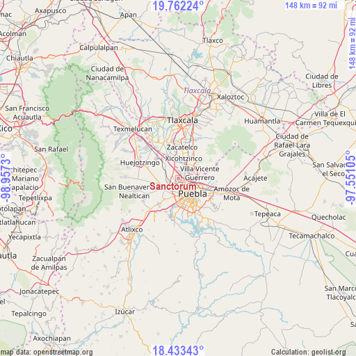
Sanctorum GPS coordinates[2]
19° 5' 57.012" North, 98° 15' 15.012" West
| Map corner | latitude | longitude |
|---|---|---|
| Upper-left | 19.76224°, | -98.9573° |
| Center: | 19.09917°, | -98.25417° |
| Lower-right: | 18.43343°, | -97.55105° |
| Map W x H: | 147.7×147.8 km | = 91.8×91.8mi |
| max Lat: | 32.7° ⇑63.1% North |
| Sanctorum: | 19.09917° |
| min Lat: | ⇓36.9% South 14.53588° |
| min Long | Sanctorum | max Long |
| -117.105° | -98.25417° | -86.73105° |
| W 60.5%⇐ | ⇒39.5% E |
Elevation
Elevation of Sanctorum is 2146 m = 7041 ft, and this is 892.3 m = 2927 ft above average elevation for this country.
| Max E: |
3497 m = 11473 ft | 19.7% |
| Sanctorum | 2146 m 7041 ft | |
| Avg. | 1253.7 m = 4113 ft | |
Min E: |
-1 m = -3 ft | 80.3% |
See also: Mexico elevation on elevation.city.
Geographical zone
Sanctorum is located in North Torrid zone (between Equator and Tropic of Cancer). Distance of this Northern Tropic circle is 482.3 km =299.7 mi to North.| Distance of | km | miles | from Sanctorum |
|---|---|---|---|
| North Pole | 7883.4 | 4898.5 | to North |
| Arctic Circle | 5277.5 | 3279.3 | to North |
| Tropic Cancer | 482.3 | 299.7 | to North |
| Equator | 2123.6 | 1319.5 | to South |


Nearby cities:
15 places around Sanctorum: (largest is in red/bold)
• Almecatla
5.2 km =3.2 mi,  21°
21°
• Barrio de Nuevo León
3.9 km =2.4 mi,  252°
252°
• Cholula
6.5 km =4 mi,  233°
233°
• Coronango
6 km =3.7 mi,  293°
293°
• Cuanalá
7.8 km =4.8 mi,  278°
278°
• Cuautlancingo
2.2 km =1.4 mi,  242°
242°
• Fuerte de Guadalupe
4.4 km =2.7 mi, 241°
• La Trinidad Chautenco
1.4 km =0.9 mi, 225°
• San Andrés Cholula
6.8 km =4.2 mi,  219°
219°
• San Antonio Mihuacán
8 km =5 mi,  318°
318°
• San Diego los Sauces
4.7 km =2.9 mi, 243°
• San Francisco Ocotlán
5 km =3.1 mi, 321°
• San Jacinto
6.1 km =3.8 mi,  5°
5°
• Santiago Momoxpan
3.1 km =1.9 mi,  205°
205°
• Tenancingo
7.7 km =4.8 mi,  46°
46°
Sources, notices
• [Note1] Compared only with cities in Mexico existing in our database
• [Src1] Map data: © OpenStreetMap contributors (CC-BY-SA)
• [Src2] Other city data from geonames.org with taken over terms of usage.
• [Src3] Geographical zone / Annual Mean Temperature by Robert A. Rohde @ Wikipedia
