Pepexta geodata
Pepexta (Puebla) is a populated place; located in Mexico in America/Mexico_City (GMT-6) time zone. With population of 914 people, there are 9545 cities with bigger population in this country. Compared to other cities in Mexico, 57.9% of cities are located further ↓South; 69.9% of cities are located further ←West and 69% of cities have higher elevation than Pepexta. Note1


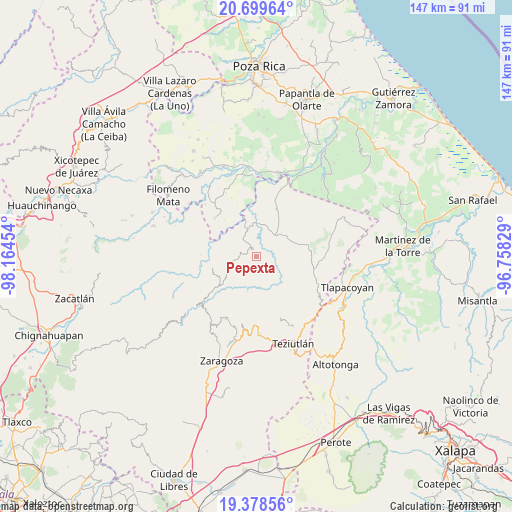
Pepexta GPS coordinates[2]
20° 2' 25.764" North, 97° 27' 41.076" West
| Map corner | latitude | longitude |
|---|---|---|
| Upper-left | 20.69964°, | -98.16454° |
| Center: | 20.04049°, | -97.46141° |
| Lower-right: | 19.37856°, | -96.75829° |
| Map W x H: | 146.9×146.9 km | = 91.3×91.3mi |
| max Lat: | 32.7° ⇑42.1% North |
| Pepexta: | 20.04049° |
| min Lat: | ⇓57.9% South 14.53588° |
| min Long | Pepexta | max Long |
| -117.105° | -97.46141° | -86.73105° |
| W 69.9%⇐ | ⇒30.1% E |
Elevation
Elevation of Pepexta is 471 m = 1545 ft, and this is 782.7 m = 2568 ft below average elevation for this country.
| Max E: |
3497 m = 11473 ft | 69% |
| Avg. | 1253.7 m = 4113 ft | |
| Pepexta | 471 m = 1545 ft | |
Min E: |
-1 m = -3 ft | 31% |
See also: Mexico elevation on elevation.city.
Geographical zone
Pepexta is located in North Torrid zone (between Equator and Tropic of Cancer). Distance of this Northern Tropic circle is 377.6 km =234.6 mi to North.| Distance of | km | miles | from Pepexta |
|---|---|---|---|
| North Pole | 7778.8 | 4833.5 | to North |
| Arctic Circle | 5172.9 | 3214.3 | to North |
| Tropic Cancer | 377.6 | 234.6 | to North |
| Equator | 2228.3 | 1384.6 | to South |


Nearby cities:
15 places around Pepexta: (largest is in red/bold)
• Ciudad de Cuetzalan
6.7 km =4.2 mi,  248°
248°
• Cuauhtamazaco
3.2 km =2 mi,  237°
237°
• Cuauhtapanaloyan
3.6 km =2.2 mi,  6°
6°
• Ixtahuata
5.2 km =3.2 mi, 247°
• Mazatepec
5.2 km =3.2 mi,  120°
120°
• Nectepec
2.4 km =1.5 mi, 117°
• Santiago Yancuictlalpan
2.5 km =1.6 mi,  333°
333°
• Tacuapan
5 km =3.1 mi,  341°
341°
• Tepetitán Reyeshogpan de Hidalgo
5.9 km =3.7 mi,  324°
324°
• Tepetzintán
6 km =3.7 mi,  281°
281°
• Tuzamapan Xiloxochico
3.4 km =2.1 mi,  303°
303°
• Xalpantzingo
2 km =1.2 mi,  210°
210°
• Xiloxochico de Rafael Ávila Camacho
3.1 km =1.9 mi, 280°
• Yohualichan
5 km =3.1 mi, 298°
• Zacatipan
2.7 km =1.7 mi,  93°
93°
Sources, notices
• [Note1] Compared only with cities in Mexico existing in our database
• [Src1] Map data: © OpenStreetMap contributors (CC-BY-SA)
• [Src2] Other city data from geonames.org with taken over terms of usage.
• [Src3] Geographical zone / Annual Mean Temperature by Robert A. Rohde @ Wikipedia
