Xalpantzingo geodata
Xalpantzingo (Puebla) is a populated place; located in Mexico in America/Mexico_City (GMT-6) time zone. With population of 601 people, there are 14318 cities with bigger population in this country. Compared to other cities in Mexico, 57.5% of cities are located further ↓South; 69.8% of cities are located further ←West and 63.9% of cities have higher elevation than Xalpantzingo. Note1


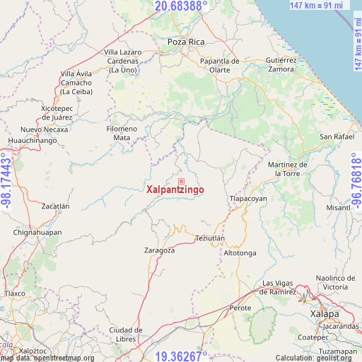
Xalpantzingo GPS coordinates[2]
20° 1' 28.776" North, 97° 28' 16.68" West
| Map corner | latitude | longitude |
|---|---|---|
| Upper-left | 20.68388°, | -98.17443° |
| Center: | 20.02466°, | -97.4713° |
| Lower-right: | 19.36267°, | -96.76818° |
| Map W x H: | 146.9×146.9 km | = 91.3×91.3mi |
| max Lat: | 32.7° ⇑42.5% North |
| Xalpantzingo: | 20.02466° |
| min Lat: | ⇓57.5% South 14.53588° |
| min Long | Xalpantzingo | max Long |
| -117.105° | -97.4713° | -86.73105° |
| W 69.8%⇐ | ⇒30.2% E |
Elevation
Elevation of Xalpantzingo is 759 m = 2490 ft, and this is 494.7 m = 1623 ft below average elevation for this country.
| Max E: |
3497 m = 11473 ft | 63.9% |
| Avg. | 1253.7 m = 4113 ft | |
| Xalpantzingo | 759 m = 2490 ft | |
Min E: |
-1 m = -3 ft | 36.1% |
See also: Mexico elevation on elevation.city.
Geographical zone
Xalpantzingo is located in North Torrid zone (between Equator and Tropic of Cancer). Distance of this Northern Tropic circle is 379.4 km =235.7 mi to North.| Distance of | km | miles | from Xalpantzingo |
|---|---|---|---|
| North Pole | 7780.5 | 4834.6 | to North |
| Arctic Circle | 5174.6 | 3215.3 | to North |
| Tropic Cancer | 379.4 | 235.7 | to North |
| Equator | 2226.5 | 1383.5 | to South |


Nearby cities:
15 places around Xalpantzingo: (largest is in red/bold)
• Ciudad de Cuetzalan
5.2 km =3.2 mi,  262°
262°
• Cuauhtamazaco
1.7 km =1.1 mi,  271°
271°
• Cuauhtapanaloyan
5.6 km =3.5 mi,  15°
15°
• Cuetzalan
5.4 km =3.4 mi, 261°
• Ixtahuata
3.8 km =2.4 mi, 266°
• Mazatepec
5.5 km =3.4 mi,  98°
98°
• Nectepec
3.2 km =2 mi,  77°
77°
• Pepexta
2 km =1.2 mi,  30°
30°
• Santiago Yancuictlalpan
4 km =2.5 mi,  358°
358°
• Tacuapan
6.5 km =4 mi,  354°
354°
• Tepetzintán
5.7 km =3.5 mi,  301°
301°
• Tuzamapan Xiloxochico
4.1 km =2.5 mi,  333°
333°
• Xiloxochico de Rafael Ávila Camacho
3.1 km =1.9 mi,  319°
319°
• Yohualichan
5.3 km =3.3 mi, 320°
• Zacatipan
4 km =2.5 mi,  67°
67°
Sources, notices
• [Note1] Compared only with cities in Mexico existing in our database
• [Src1] Map data: © OpenStreetMap contributors (CC-BY-SA)
• [Src2] Other city data from geonames.org with taken over terms of usage.
• [Src3] Geographical zone / Annual Mean Temperature by Robert A. Rohde @ Wikipedia
