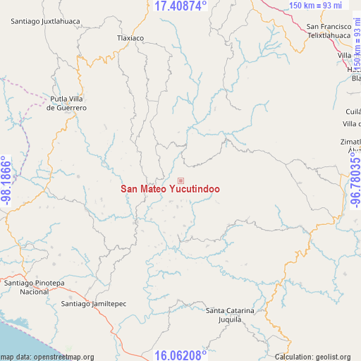
San Mateo Yucutindoo geodata
San Mateo Yucutindoo (Oaxaca) is a populated place; located in Mexico in America/Mexico_City (GMT-6) time zone. With population of 655 people, there are 13244 cities with bigger population in this country. Compared to other cities in Mexico, 92.4% of cities are located further ↑North; 69.7% of cities are located further ←West and 53.6% of cities have higher elevation than San Mateo Yucutindoo. Note1
Current local time in San Mateo Yucutindoo:
08:29 AM, WednesdayDifference from your time zone: hours


San Mateo Yucutindoo GPS coordinates[2]
16° 44' 11.76" North, 97° 29' 0.492" West
| Map corner | latitude | longitude |
|---|---|---|
| Upper-left | 17.40874°, | -98.1866° |
| Center: | 16.7366°, | -97.48347° |
| Lower-right: | 16.06208°, | -96.78035° |
| Map W x H: | 149.7×149.7 km | = 93×93mi |
| max Lat: | 32.7° ⇑92.4% North |
| San Mateo Yucutindoo: | 16.7366° |
| min Lat: | ⇓7.6% South 14.53588° |
| min Long | San Mateo Yucut | max Long |
| -117.105° | -97.48347° | -86.73105° |
| W 69.7%⇐ | ⇒30.3% E |
Elevation
Elevation of San Mateo Yucutindoo is 1265 m = 4150 ft, and this is 11.3 m = 37 ft above average elevation for this country.
| Max E: |
3497 m = 11473 ft | 53.6% |
| San Mateo Yucutindoo | 1265 m 4150 ft | |
| Avg. | 1253.7 m = 4113 ft | |
Min E: |
-1 m = -3 ft | 46.4% |
See also: Mexico elevation on elevation.city.
Geographical zone
San Mateo Yucutindoo is located in North Torrid zone (between Equator and Tropic of Cancer). Distance of this Northern Tropic circle is 745 km =462.9 mi to North.| Distance of | km | miles | from San Mateo Yucutindoo |
|---|---|---|---|
| North Pole | 8146.1 | 5061.8 | to North |
| Arctic Circle | 5540.2 | 3442.5 | to North |
| Tropic Cancer | 745 | 462.9 | to North |
| Equator | 1860.9 | 1156.3 | to South |


Nearby cities:
15 places around San Mateo Yucutindoo: (largest is in red/bold)
• Colonia de Jesús (La Cucaracha)
10.5 km =6.5 mi,  178°
178°
• El Carrizal
23.1 km =14.4 mi,  169°
169°
• La Independencia
15.8 km =9.8 mi,  251°
251°
• Llano Nuevo
15.3 km =9.5 mi,  189°
189°
• Mano del Señor
17.4 km =10.8 mi, 165°
• Morelos
21.6 km =13.4 mi,  287°
287°
• Piedra Grande
19.9 km =12.4 mi,  196°
196°
• Piedra del Tambor
9.5 km =5.9 mi,  205°
205°
• San Sebastián Yutanino
6.5 km =4 mi,  21°
21°
• Santa Catarina Cuanana
8.7 km =5.4 mi,  8°
8°
• Santa Cruz Tacahua
20.3 km =12.6 mi,  357°
357°
• Santa Cruz Zenzontepec
22.6 km =14 mi, 183°
• Santa María Zaniza
18 km =11.2 mi,  120°
120°
• Santiago Amoltepec
10.5 km =6.5 mi, 187°
• Santiago Yosondúa
18.4 km =11.4 mi,  327°
327°
Sources, notices
• [Note1] Compared only with cities in Mexico existing in our database
• [Src1] Map data: © OpenStreetMap contributors (CC-BY-SA)
• [Src2] Other city data from geonames.org with taken over terms of usage.
• [Src3] Geographical zone / Annual Mean Temperature by Robert A. Rohde @ Wikipedia
