Xilotepec (Jilotepec Chiquito) geodata
Xilotepec (Jilotepec Chiquito) (Guerrero) is a populated place; located in Mexico in America/Mexico_City (GMT-6) time zone. With population of 890 people, there are 9797 cities with bigger population in this country. Compared to other cities in Mexico, 84.1% of cities are located further ↑North; 56.6% of cities are located further ←West and 65.2% of cities have lower elevation than Xilotepec (Jilotepec Chiquito). Note1
Current local time in Xilotepec (Jilotepec Chiquito):
07:23 AM, MondayDifference from your time zone: hours


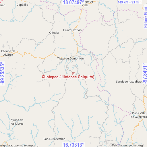
Xilotepec (Jilotepec Chiquito) GPS coordinates[2]
17° 24' 19.008" North, 98° 33' 7.992" West
| Map corner | latitude | longitude |
|---|---|---|
| Upper-left | 18.07497°, | -99.25535° |
| Center: | 17.40528°, | -98.55222° |
| Lower-right: | 16.73313°, | -97.8491° |
| Map W x H: | 149.2×149.2 km | = 92.7×92.7mi |
| max Lat: | 32.7° ⇑84.1% North |
| Xilotepec (Jilotepec Chiquito): | 17.40528° |
| min Lat: | ⇓15.9% South 14.53588° |
| min Long | Xilotepec (Jilo | max Long |
| -117.105° | -98.55222° | -86.73105° |
| W 56.6%⇐ | ⇒43.4% E |
Elevation
Elevation of Xilotepec (Jilotepec Chiquito) is 1834 m = 6017 ft, and this is 580.3 m = 1904 ft above average elevation for this country.
| Max E: |
3497 m = 11473 ft | 34.8% |
| Xilotepec (Jilotepec Chiquito) | 1834 m 6017 ft | |
| Avg. | 1253.7 m = 4113 ft | |
Min E: |
-1 m = -3 ft | 65.2% |
See also: Mexico elevation on elevation.city.
Geographical zone
Xilotepec (Jilotepec Chiquito) is located in North Torrid zone (between Equator and Tropic of Cancer). Distance of this Northern Tropic circle is 670.6 km =416.7 mi to North.| Distance of | km | miles | from Xilotepec (Jilotepec Chiquito) |
|---|---|---|---|
| North Pole | 8071.8 | 5015.6 | to North |
| Arctic Circle | 5465.9 | 3396.4 | to North |
| Tropic Cancer | 670.6 | 416.7 | to North |
| Equator | 1935.3 | 1202.5 | to South |


Nearby cities:
15 places around Xilotepec (Jilotepec Chiquito): (largest is in red/bold)
• Atlamajalcingo del Monte
11.8 km =7.3 mi,  207°
207°
• Cahuatache
2.5 km =1.6 mi,  60°
60°
• Cuba Libre
10.1 km =6.3 mi,  34°
34°
• El Platanar (Santa María Guadalupe el Platanar)
10.4 km =6.5 mi, 27°
• Igualita
7.2 km =4.5 mi, 31°
• Juanacatlán
9.6 km =6 mi,  153°
153°
• Lomazóyatl (Lomazoya)
11.3 km =7 mi,  120°
120°
• Santa Cruz
9.8 km =6.1 mi,  171°
171°
• Santa María Tonaya
5.5 km =3.4 mi,  137°
137°
• Tepecocatlán
11.4 km =7.1 mi,  217°
217°
• Tototepec
4.8 km =3 mi,  309°
309°
• Xalatzala
7.9 km =4.9 mi,  343°
343°
• Xalpatlahuac
9.3 km =5.8 mi,  321°
321°
• Xochapa
11 km =6.8 mi,  102°
102°
• Zacatipa
8.1 km =5 mi,  328°
328°
Sources, notices
• [Note1] Compared only with cities in Mexico existing in our database
• [Src1] Map data: © OpenStreetMap contributors (CC-BY-SA)
• [Src2] Other city data from geonames.org with taken over terms of usage.
• [Src3] Geographical zone / Annual Mean Temperature by Robert A. Rohde @ Wikipedia
