Lomazóyatl (Lomazoya) geodata
Lomazóyatl (Lomazoya) (Guerrero) is a populated place; located in Mexico in America/Mexico_City (GMT-6) time zone. With population of 968 people, there are 8990 cities with bigger population in this country. Compared to other cities in Mexico, 84.7% of cities are located further ↑North; 57.8% of cities are located further ←West and 57.7% of cities have lower elevation than Lomazóyatl (Lomazoya). Note1


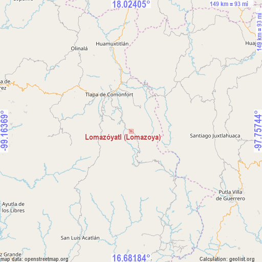
Lomazóyatl (Lomazoya) GPS coordinates[2]
17° 21' 15.012" North, 98° 27' 38.016" West
| Map corner | latitude | longitude |
|---|---|---|
| Upper-left | 18.02405°, | -99.16369° |
| Center: | 17.35417°, | -98.46056° |
| Lower-right: | 16.68184°, | -97.75744° |
| Map W x H: | 149.2×149.2 km | = 92.7×92.7mi |
| max Lat: | 32.7° ⇑84.7% North |
| Lomazóyatl (Lomazoya): | 17.35417° |
| min Lat: | ⇓15.3% South 14.53588° |
| min Long | Lomazóyatl (Lo | max Long |
| -117.105° | -98.46056° | -86.73105° |
| W 57.8%⇐ | ⇒42.2% E |
Elevation
Elevation of Lomazóyatl (Lomazoya) is 1682 m = 5518 ft, and this is 428.3 m = 1405 ft above average elevation for this country.
| Max E: |
3497 m = 11473 ft | 42.3% |
| Lomazóyatl (Lomazoya) | 1682 m 5518 ft | |
| Avg. | 1253.7 m = 4113 ft | |
Min E: |
-1 m = -3 ft | 57.7% |
See also: Mexico elevation on elevation.city.
Geographical zone
Lomazóyatl (Lomazoya) is located in North Torrid zone (between Equator and Tropic of Cancer). Distance of this Northern Tropic circle is 676.3 km =420.2 mi to North.| Distance of | km | miles | from Lomazóyatl (Lomazoya) |
|---|---|---|---|
| North Pole | 8077.5 | 5019.1 | to North |
| Arctic Circle | 5471.6 | 3399.9 | to North |
| Tropic Cancer | 676.3 | 420.2 | to North |
| Equator | 1929.6 | 1199 | to South |


Nearby cities:
15 places around Lomazóyatl (Lomazoya): (largest is in red/bold)
• Cahuatache
10.2 km =6.3 mi,  312°
312°
• Cocuilotlazala
6.9 km =4.3 mi,  149°
149°
• Francisco I. Madero
7.4 km =4.6 mi,  223°
223°
• Huexoapa (San Juan Huexoapa)
12.6 km =7.8 mi,  156°
156°
• Igualita
13.2 km =8.2 mi,  333°
333°
• Juanacatlán
6.2 km =3.9 mi,  241°
241°
• Melchor Ocampo
1.5 km =0.9 mi,  68°
68°
• San Juan Puerto Montaña
10.5 km =6.5 mi, 217°
• San Vicente Zoyatlán
10.8 km =6.7 mi,  108°
108°
• Santa Cruz
9.2 km =5.7 mi, 243°
• Santa María Tonaya
6.2 km =3.9 mi,  284°
284°
• Tierra Blanca
9.4 km =5.8 mi,  185°
185°
• Xilotepec (Jilotepec Chiquito)
11.3 km =7 mi,  300°
300°
• Xochapa
3.5 km =2.2 mi,  16°
16°
• Zilacayotitlán
11.5 km =7.1 mi, 235°
Sources, notices
• [Note1] Compared only with cities in Mexico existing in our database
• [Src1] Map data: © OpenStreetMap contributors (CC-BY-SA)
• [Src2] Other city data from geonames.org with taken over terms of usage.
• [Src3] Geographical zone / Annual Mean Temperature by Robert A. Rohde @ Wikipedia
