Llano de Agua geodata
Llano de Agua (Oaxaca) is a populated place; located in Mexico in America/Mexico_City (GMT-6) time zone. With population of 1,108 people, there are 7843 cities with bigger population in this country. Compared to other cities in Mexico, 77.5% of cities are located further ↑North; 77.1% of cities are located further ←West and 56.7% of cities have lower elevation than Llano de Agua. Note1


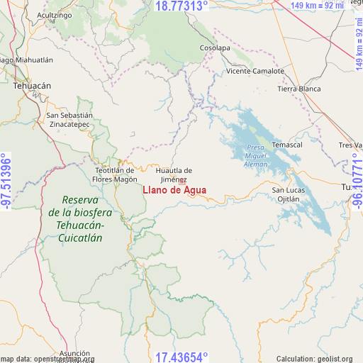
Llano de Agua GPS coordinates[2]
18° 6' 21.996" North, 96° 48' 38.988" West
| Map corner | latitude | longitude |
|---|---|---|
| Upper-left | 18.77313°, | -97.51396° |
| Center: | 18.10611°, | -96.81083° |
| Lower-right: | 17.43654°, | -96.10771° |
| Map W x H: | 148.6×148.6 km | = 92.3×92.3mi |
| max Lat: | 32.7° ⇑77.5% North |
| Llano de Agua: | 18.10611° |
| min Lat: | ⇓22.5% South 14.53588° |
| min Long | Llano de Agua | max Long |
| -117.105° | -96.81083° | -86.73105° |
| W 77.1%⇐ | ⇒22.9% E |
Elevation
Elevation of Llano de Agua is 1644 m = 5394 ft, and this is 390.3 m = 1281 ft above average elevation for this country.
| Max E: |
3497 m = 11473 ft | 43.3% |
| Llano de Agua | 1644 m 5394 ft | |
| Avg. | 1253.7 m = 4113 ft | |
Min E: |
-1 m = -3 ft | 56.7% |
See also: Mexico elevation on elevation.city.
Geographical zone
Llano de Agua is located in North Torrid zone (between Equator and Tropic of Cancer). Distance of this Northern Tropic circle is 592.7 km =368.3 mi to North.| Distance of | km | miles | from Llano de Agua |
|---|---|---|---|
| North Pole | 7993.9 | 4967.2 | to North |
| Arctic Circle | 5388 | 3347.9 | to North |
| Tropic Cancer | 592.7 | 368.3 | to North |
| Equator | 2013.2 | 1250.9 | to South |


Nearby cities:
15 places around Llano de Agua: (largest is in red/bold)
• El Camarón
4.7 km =2.9 mi,  167°
167°
• El Carrizal
5 km =3.1 mi,  266°
266°
• Huautepec
1.7 km =1.1 mi,  108°
108°
• Huautla de Jiménez
4.2 km =2.6 mi,  311°
311°
• La Reforma San Mateo
6.9 km =4.3 mi,  295°
295°
• Loma Chapultepec
3.4 km =2.1 mi, 296°
• Loma Chilar
4.3 km =2.7 mi,  336°
336°
• Río Santiago
5.6 km =3.5 mi,  70°
70°
• San Andrés Hidalgo
3.5 km =2.2 mi,  8°
8°
• San Juan Coatzospam
8 km =5 mi,  141°
141°
• San Mateo Yoloxochitlán
7.4 km =4.6 mi, 304°
• Santa Catarina Buenavista
3.3 km =2.1 mi, 167°
• Santa Cruz de Juárez
5.6 km =3.5 mi,  332°
332°
• Santa María la Asunción
0.9 km =0.6 mi,  277°
277°
• Xochitonalco
4.2 km =2.6 mi,  251°
251°
Sources, notices
• [Note1] Compared only with cities in Mexico existing in our database
• [Src1] Map data: © OpenStreetMap contributors (CC-BY-SA)
• [Src2] Other city data from geonames.org with taken over terms of usage.
• [Src3] Geographical zone / Annual Mean Temperature by Robert A. Rohde @ Wikipedia
