El Carrizal geodata
El Carrizal (Oaxaca) is a populated place; located in Mexico in America/Mexico_City (GMT-6) time zone. With population of 579 people, there are 14804 cities with bigger population in this country. Compared to other cities in Mexico, 77.5% of cities are located further ↑North; 76.6% of cities are located further ←West and 64.3% of cities have lower elevation than El Carrizal. Note1


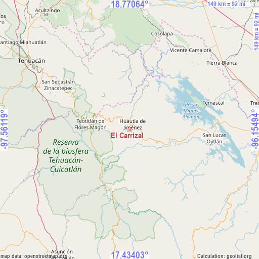
El Carrizal GPS coordinates[2]
18° 6' 12.996" North, 96° 51' 29.016" West
| Map corner | latitude | longitude |
|---|---|---|
| Upper-left | 18.77064°, | -97.56119° |
| Center: | 18.10361°, | -96.85806° |
| Lower-right: | 17.43403°, | -96.15494° |
| Map W x H: | 148.6×148.6 km | = 92.3×92.3mi |
| max Lat: | 32.7° ⇑77.5% North |
| El Carrizal: | 18.10361° |
| min Lat: | ⇓22.5% South 14.53588° |
| min Long | El Carrizal | max Long |
| -117.105° | -96.85806° | -86.73105° |
| W 76.6%⇐ | ⇒23.4% E |
Elevation
Elevation of El Carrizal is 1809 m = 5935 ft, and this is 555.3 m = 1822 ft above average elevation for this country.
| Max E: |
3497 m = 11473 ft | 35.7% |
| El Carrizal | 1809 m 5935 ft | |
| Avg. | 1253.7 m = 4113 ft | |
Min E: |
-1 m = -3 ft | 64.3% |
See also: Mexico elevation on elevation.city.
Geographical zone
El Carrizal is located in North Torrid zone (between Equator and Tropic of Cancer). Distance of this Northern Tropic circle is 593 km =368.5 mi to North.| Distance of | km | miles | from El Carrizal |
|---|---|---|---|
| North Pole | 7994.1 | 4967.3 | to North |
| Arctic Circle | 5388.2 | 3348.1 | to North |
| Tropic Cancer | 593 | 368.5 | to North |
| Equator | 2012.9 | 1250.8 | to South |


Nearby cities:
15 places around El Carrizal: (largest is in red/bold)
• Huautepec
6.6 km =4.1 mi,  92°
92°
• Huautla de Jiménez
3.6 km =2.2 mi,  30°
30°
• La Reforma San Mateo
3.4 km =2.1 mi,  338°
338°
• Llano de Agua
5 km =3.1 mi, 86°
• Loma Chapultepec
2.7 km =1.7 mi,  48°
48°
• Loma Chilar
5.4 km =3.4 mi,  37°
37°
• San Andrés Hidalgo
6.7 km =4.2 mi,  55°
55°
• San Isidro Zoquiápam
7.2 km =4.5 mi,  264°
264°
• San Lucas Zoquiápam
6.2 km =3.9 mi,  306°
306°
• San Mateo Yoloxochitlán
4.6 km =2.9 mi,  345°
345°
• Santa Catarina Buenavista
6.4 km =4 mi,  117°
117°
• Santa Cruz Acatepec
6.9 km =4.3 mi, 344°
• Santa Cruz de Juárez
5.7 km =3.5 mi,  24°
24°
• Santa María la Asunción
4.1 km =2.5 mi,  84°
84°
• Xochitonalco
1.4 km =0.9 mi,  135°
135°
Sources, notices
• [Note1] Compared only with cities in Mexico existing in our database
• [Src1] Map data: © OpenStreetMap contributors (CC-BY-SA)
• [Src2] Other city data from geonames.org with taken over terms of usage.
• [Src3] Geographical zone / Annual Mean Temperature by Robert A. Rohde @ Wikipedia
