El Porvenir geodata
El Porvenir (Oaxaca) is a populated place; located in Mexico in America/Mexico_City (GMT-6) time zone. With population of 879 people, there are 9939 cities with bigger population in this country. Compared to other cities in Mexico, 72.5% of cities are located further ↑North; 79.8% of cities are located further ←West and 78.8% of cities have higher elevation than El Porvenir. Note1


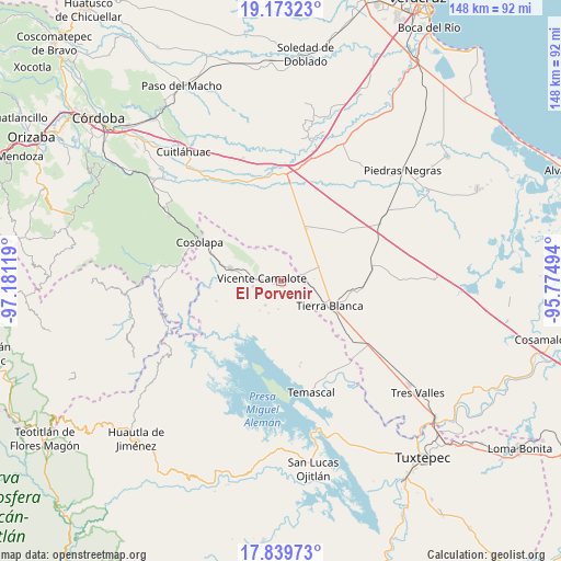
El Porvenir GPS coordinates[2]
18° 30' 28.008" North, 96° 28' 41.016" West
| Map corner | latitude | longitude |
|---|---|---|
| Upper-left | 19.17323°, | -97.18119° |
| Center: | 18.50778°, | -96.47806° |
| Lower-right: | 17.83973°, | -95.77494° |
| Map W x H: | 148.3×148.3 km | = 92.1×92.1mi |
| max Lat: | 32.7° ⇑72.5% North |
| El Porvenir: | 18.50778° |
| min Lat: | ⇓27.5% South 14.53588° |
| min Long | El Porvenir | max Long |
| -117.105° | -96.47806° | -86.73105° |
| W 79.8%⇐ | ⇒20.2% E |
Elevation
Elevation of El Porvenir is 115 m = 377 ft, and this is 1138.7 m = 3736 ft below average elevation for this country.
| Max E: |
3497 m = 11473 ft | 78.8% |
| Avg. | 1253.7 m = 4113 ft | |
| El Porvenir | 115 m = 377 ft | |
Min E: |
-1 m = -3 ft | 21.2% |
See also: Mexico elevation on elevation.city.
Geographical zone
El Porvenir is located in North Torrid zone (between Equator and Tropic of Cancer). Distance of this Northern Tropic circle is 548 km =340.5 mi to North.| Distance of | km | miles | from El Porvenir |
|---|---|---|---|
| North Pole | 7949.2 | 4939.4 | to North |
| Arctic Circle | 5343.3 | 3320.2 | to North |
| Tropic Cancer | 548 | 340.5 | to North |
| Equator | 2057.9 | 1278.7 | to South |


Nearby cities:
15 places around El Porvenir: (largest is in red/bold)
• Acatlán de Pérez Figueroa
13.9 km =8.6 mi,  284°
284°
• Arroyo de Enmedio
7.4 km =4.6 mi,  261°
261°
• Barbasco
12.1 km =7.5 mi,  314°
314°
• Carbonera
8.8 km =5.5 mi,  141°
141°
• Cañamazal
6.6 km =4.1 mi,  344°
344°
• El Amate
10.7 km =6.6 mi,  69°
69°
• El Quechuleño
7.6 km =4.7 mi,  26°
26°
• La Defensa
6.7 km =4.2 mi, 264°
• La Palma
6.5 km =4 mi,  133°
133°
• Serenilla de Abajo
11.2 km =7 mi,  52°
52°
• Tembladera de la Selva 1
7.6 km =4.7 mi,  213°
213°
• Tembladera del Castillo
12.9 km =8 mi,  190°
190°
• Tetela
2 km =1.2 mi,  86°
86°
• Vicente Camalote
5.4 km =3.4 mi, 277°
• Zona Urbana Ejidal
12 km =7.5 mi, 283°
Sources, notices
• [Note1] Compared only with cities in Mexico existing in our database
• [Src1] Map data: © OpenStreetMap contributors (CC-BY-SA)
• [Src2] Other city data from geonames.org with taken over terms of usage.
• [Src3] Geographical zone / Annual Mean Temperature by Robert A. Rohde @ Wikipedia
