Barbasco geodata
Barbasco (Oaxaca) is a populated place; located in Mexico in America/Mexico_City (GMT-6) time zone. With population of 875 people, there are 9983 cities with bigger population in this country. Compared to other cities in Mexico, 71.6% of cities are located further ↑North; 79.3% of cities are located further ←West and 77.1% of cities have higher elevation than Barbasco. Note1


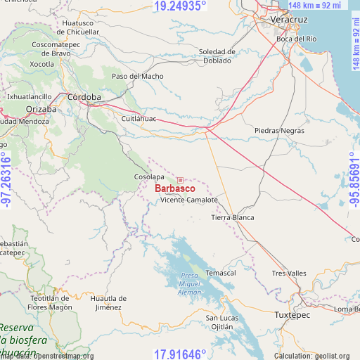
Barbasco GPS coordinates[2]
18° 35' 3.156" North, 96° 33' 36.108" West
| Map corner | latitude | longitude |
|---|---|---|
| Upper-left | 19.24935°, | -97.26316° |
| Center: | 18.58421°, | -96.56003° |
| Lower-right: | 17.91646°, | -95.85691° |
| Map W x H: | 148.2×148.2 km | = 92.1×92.1mi |
| max Lat: | 32.7° ⇑71.6% North |
| Barbasco: | 18.58421° |
| min Lat: | ⇓28.4% South 14.53588° |
| min Long | Barbasco | max Long |
| -117.105° | -96.56003° | -86.73105° |
| W 79.3%⇐ | ⇒20.7% E |
Elevation
Elevation of Barbasco is 152 m = 499 ft, and this is 1101.7 m = 3615 ft below average elevation for this country.
| Max E: |
3497 m = 11473 ft | 77.1% |
| Avg. | 1253.7 m = 4113 ft | |
| Barbasco | 152 m = 499 ft | |
Min E: |
-1 m = -3 ft | 22.9% |
See also: Mexico elevation on elevation.city.
Geographical zone
Barbasco is located in North Torrid zone (between Equator and Tropic of Cancer). Distance of this Northern Tropic circle is 539.5 km =335.2 mi to North.| Distance of | km | miles | from Barbasco |
|---|---|---|---|
| North Pole | 7940.7 | 4934.1 | to North |
| Arctic Circle | 5334.8 | 3314.9 | to North |
| Tropic Cancer | 539.5 | 335.2 | to North |
| Equator | 2066.4 | 1284 | to South |


Nearby cities:
15 places around Barbasco: (largest is in red/bold)
• Acatlán de Pérez Figueroa
6.9 km =4.3 mi,  224°
224°
• Almolonga
11 km =6.8 mi,  284°
284°
• Arroyo de Enmedio
9.7 km =6 mi,  172°
172°
• Cañamazal
7.2 km =4.5 mi,  106°
106°
• Colonia Primero de Mayo
10.7 km =6.6 mi,  327°
327°
• El Porvenir
12.1 km =7.5 mi,  134°
134°
• El Quechuleño
12.2 km =7.6 mi,  98°
98°
• Huixcolotla
11.2 km =7 mi,  36°
36°
• La Defensa
9.4 km =5.8 mi, 168°
• Loma del Izote (Mata Planta)
6.4 km =4 mi,  313°
313°
• Palma Sola
7.9 km =4.9 mi,  299°
299°
• Paso Amapa
12.1 km =7.5 mi, 307°
• Paso Nuevo
2.9 km =1.8 mi,  324°
324°
• Vicente Camalote
8.4 km =5.2 mi,  157°
157°
• Zona Urbana Ejidal
6.5 km =4 mi,  208°
208°
Sources, notices
• [Note1] Compared only with cities in Mexico existing in our database
• [Src1] Map data: © OpenStreetMap contributors (CC-BY-SA)
• [Src2] Other city data from geonames.org with taken over terms of usage.
• [Src3] Geographical zone / Annual Mean Temperature by Robert A. Rohde @ Wikipedia
