Santas Marías geodata
Santas Marías (Michoacán) is a populated place; located in Mexico in America/Mexico_City (GMT-6) time zone. With population of 878 people, there are 9946 cities with bigger population in this country. Compared to other cities in Mexico, 59.7% of cities are located further ↑North; 77.6% of cities are located further →East and 71.4% of cities have lower elevation than Santas Marías. Note1


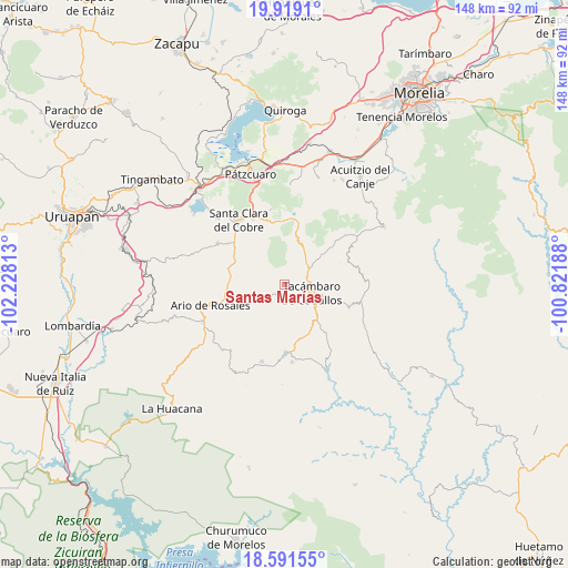
Santas Marías GPS coordinates[2]
19° 15' 24.012" North, 101° 31' 30" West
| Map corner | latitude | longitude |
|---|---|---|
| Upper-left | 19.9191°, | -102.22813° |
| Center: | 19.25667°, | -101.525° |
| Lower-right: | 18.59155°, | -100.82188° |
| Map W x H: | 147.6×147.6 km | = 91.7×91.7mi |
| max Lat: | 32.7° ⇑59.7% North |
| Santas Marías: | 19.25667° |
| min Lat: | ⇓40.3% South 14.53588° |
| min Long | Santas Marías | max Long |
| -117.105° | -101.525° | -86.73105° |
| W 22.4%⇐ | ⇒77.6% E |
Elevation
Elevation of Santas Marías is 1955 m = 6414 ft, and this is 701.3 m = 2301 ft above average elevation for this country.
| Max E: |
3497 m = 11473 ft | 28.6% |
| Santas Marías | 1955 m 6414 ft | |
| Avg. | 1253.7 m = 4113 ft | |
Min E: |
-1 m = -3 ft | 71.4% |
See also: Mexico elevation on elevation.city.
Geographical zone
Santas Marías is located in North Torrid zone (between Equator and Tropic of Cancer). Distance of this Northern Tropic circle is 464.8 km =288.8 mi to North.| Distance of | km | miles | from Santas Marías |
|---|---|---|---|
| North Pole | 7865.9 | 4887.6 | to North |
| Arctic Circle | 5260 | 3268.4 | to North |
| Tropic Cancer | 464.8 | 288.8 | to North |
| Equator | 2141.1 | 1330.4 | to South |


Nearby cities:
15 places around Santas Marías: (largest is in red/bold)
• Canícuaro
9.8 km =6.1 mi,  106°
106°
• El Tepamal
9.7 km =6 mi,  259°
259°
• El Terrero
3 km =1.9 mi,  178°
178°
• La Viña
5.9 km =3.7 mi,  80°
80°
• Las Hoyas Altas
11.2 km =7 mi,  103°
103°
• San José Grande
5.3 km =3.3 mi,  225°
225°
• San José de los Laureles
11.2 km =7 mi,  37°
37°
• San Juan de Viña
10.9 km =6.8 mi,  26°
26°
• San Miguel Tamácuaro
9.2 km =5.7 mi, 98°
• San Rafael Tecario
5.5 km =3.4 mi,  158°
158°
• Serrano
2.9 km =1.8 mi, 39°
• Tacámbaro de Codallos
7.4 km =4.6 mi, 108°
• Tecario
3.4 km =2.1 mi,  217°
217°
• Testerazo
7 km =4.3 mi, 99°
• Zatzio (Tzatzio)
9.1 km =5.7 mi,  244°
244°
Sources, notices
• [Note1] Compared only with cities in Mexico existing in our database
• [Src1] Map data: © OpenStreetMap contributors (CC-BY-SA)
• [Src2] Other city data from geonames.org with taken over terms of usage.
• [Src3] Geographical zone / Annual Mean Temperature by Robert A. Rohde @ Wikipedia
