San José Grande geodata
San José Grande (Michoacán) is a populated place; located in Mexico in America/Mexico_City (GMT-6) time zone. With population of 515 people, there are 16340 cities with bigger population in this country. Compared to other cities in Mexico, 60.6% of cities are located further ↑North; 77.9% of cities are located further →East and 67% of cities have lower elevation than San José Grande. Note1


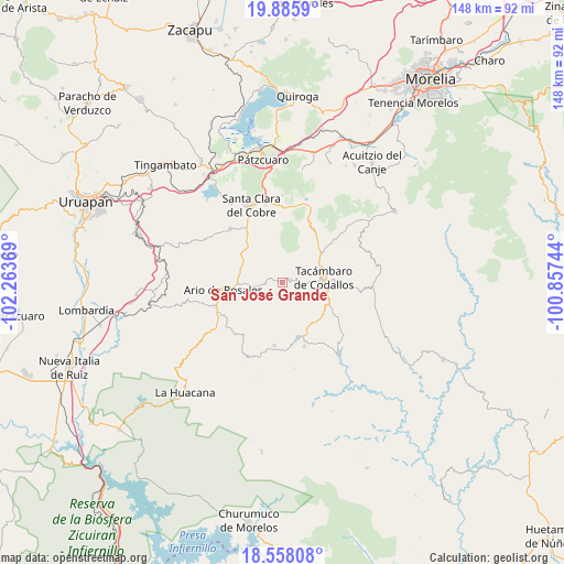
San José Grande GPS coordinates[2]
19° 13' 23.988" North, 101° 33' 38.016" West
| Map corner | latitude | longitude |
|---|---|---|
| Upper-left | 19.8859°, | -102.26369° |
| Center: | 19.22333°, | -101.56056° |
| Lower-right: | 18.55808°, | -100.85744° |
| Map W x H: | 147.6×147.6 km | = 91.7×91.7mi |
| max Lat: | 32.7° ⇑60.6% North |
| San José Grande: | 19.22333° |
| min Lat: | ⇓39.4% South 14.53588° |
| min Long | San José Grand | max Long |
| -117.105° | -101.56056° | -86.73105° |
| W 22.1%⇐ | ⇒77.9% E |
Elevation
Elevation of San José Grande is 1870 m = 6135 ft, and this is 616.3 m = 2022 ft above average elevation for this country.
| Max E: |
3497 m = 11473 ft | 33% |
| San José Grande | 1870 m 6135 ft | |
| Avg. | 1253.7 m = 4113 ft | |
Min E: |
-1 m = -3 ft | 67% |
See also: Mexico elevation on elevation.city.
Geographical zone
San José Grande is located in North Torrid zone (between Equator and Tropic of Cancer). Distance of this Northern Tropic circle is 468.5 km =291.1 mi to North.| Distance of | km | miles | from San José Grande |
|---|---|---|---|
| North Pole | 7869.6 | 4889.9 | to North |
| Arctic Circle | 5263.7 | 3270.7 | to North |
| Tropic Cancer | 468.5 | 291.1 | to North |
| Equator | 2137.4 | 1328.1 | to South |


Nearby cities:
15 places around San José Grande: (largest is in red/bold)
• Chupio
13 km =8.1 mi,  112°
112°
• El Chupadero
8.4 km =5.2 mi,  241°
241°
• El Tepamal
6.1 km =3.8 mi,  288°
288°
• El Terrero
3.9 km =2.4 mi,  79°
79°
• La Viña
10.7 km =6.6 mi,  63°
63°
• Los Hacheros
9.2 km =5.7 mi,  185°
185°
• Pablo Cuin
10.6 km =6.6 mi,  268°
268°
• San Miguel Tamácuaro
13 km =8.1 mi, 79°
• San Rafael Tecario
5.9 km =3.7 mi,  103°
103°
• Santas Marías
5.3 km =3.3 mi,  45°
45°
• Serrano
8.2 km =5.1 mi,  43°
43°
• Tacámbaro de Codallos
10.8 km =6.7 mi, 83°
• Tecario
2 km =1.2 mi, 59°
• Testerazo
10.9 km =6.8 mi, 76°
• Zatzio (Tzatzio)
4.5 km =2.8 mi, 267°
Sources, notices
• [Note1] Compared only with cities in Mexico existing in our database
• [Src1] Map data: © OpenStreetMap contributors (CC-BY-SA)
• [Src2] Other city data from geonames.org with taken over terms of usage.
• [Src3] Geographical zone / Annual Mean Temperature by Robert A. Rohde @ Wikipedia
