Laguna Seca geodata
Laguna Seca (Zacatecas) is a populated place; located in Mexico in America/Mexico_City (GMT-6) time zone. With population of 873 people, there are 10005 cities with bigger population in this country. Compared to other cities in Mexico, 88.4% of cities are located further ↓South; 85.1% of cities are located further →East and 78.4% of cities have lower elevation than Laguna Seca. Note1


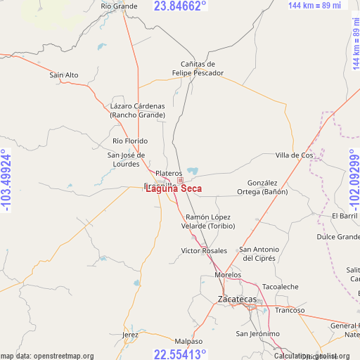
Laguna Seca GPS coordinates[2]
23° 12' 6.984" North, 102° 47' 45.996" West
| Map corner | latitude | longitude |
|---|---|---|
| Upper-left | 23.84662°, | -103.49924° |
| Center: | 23.20194°, | -102.79611° |
| Lower-right: | 22.55413°, | -102.09299° |
| Map W x H: | 143.7×143.7 km | = 89.3×89.3mi |
| max Lat: | 32.7° ⇑11.6% North |
| Laguna Seca: | 23.20194° |
| min Lat: | ⇓88.4% South 14.53588° |
| min Long | Laguna Seca | max Long |
| -117.105° | -102.79611° | -86.73105° |
| W 14.9%⇐ | ⇒85.1% E |
Elevation
Elevation of Laguna Seca is 2097 m = 6880 ft, and this is 843.3 m = 2767 ft above average elevation for this country.
| Max E: |
3497 m = 11473 ft | 21.6% |
| Laguna Seca | 2097 m 6880 ft | |
| Avg. | 1253.7 m = 4113 ft | |
Min E: |
-1 m = -3 ft | 78.4% |
See also: Mexico elevation on elevation.city.
Geographical zone
Laguna Seca is located in North Torrid zone (between Equator and Tropic of Cancer). Distance of this Northern Tropic circle is 26.1 km =16.2 mi to North.| Distance of | km | miles | from Laguna Seca |
|---|---|---|---|
| North Pole | 7427.2 | 4615 | to North |
| Arctic Circle | 4821.4 | 2995.9 | to North |
| Tropic Cancer | 26.1 | 16.2 | to North |
| Equator | 2579.8 | 1603 | to South |


Nearby cities:
15 places around Laguna Seca: (largest is in red/bold)
• Carrillo
19.5 km =12.1 mi,  270°
270°
• Chichimequillas
22.6 km =14 mi,  79°
79°
• Colonia Santa Anita
4.2 km =2.6 mi,  44°
44°
• Estación San José
1.8 km =1.1 mi,  139°
139°
• Fraccionamiento San Felipe
2.7 km =1.7 mi,  205°
205°
• Fresnillo
8 km =5 mi,  253°
253°
• General Enrique Estrada
23.4 km =14.5 mi,  166°
166°
• Hacienda Toribio
17.5 km =10.9 mi, 138°
• Las Catarinas
22.2 km =13.8 mi,  123°
123°
• México Nuevo Uno (México Nuevo)
22.5 km =14 mi,  264°
264°
• Plateros
5.7 km =3.5 mi,  302°
302°
• Ramón López Velarde
14.1 km =8.8 mi, 302°
• San Gabriel
22.7 km =14.1 mi, 298°
• San Jose de Lourdes
23.3 km =14.5 mi,  290°
290°
• Santiaguillo
15.9 km =9.9 mi,  112°
112°
Sources, notices
• [Note1] Compared only with cities in Mexico existing in our database
• [Src1] Map data: © OpenStreetMap contributors (CC-BY-SA)
• [Src2] Other city data from geonames.org with taken over terms of usage.
• [Src3] Geographical zone / Annual Mean Temperature by Robert A. Rohde @ Wikipedia
