19 de Febrero de 1812 geodata
19 de Febrero de 1812 (Morelos) is a populated place; located in Mexico in America/Mexico_City (GMT-6) time zone. With population of 871 people, there are 10028 cities with bigger population in this country. Compared to other cities in Mexico, 67.5% of cities are located further ↑North; 50.8% of cities are located further ←West and 51.3% of cities have higher elevation than 19 de Febrero de 1812. Note1
Current local time in 19 de Febrero de 1812:
06:48 AM, WednesdayDifference from your time zone: hours


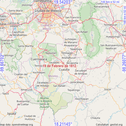
19 de Febrero de 1812 GPS coordinates[2]
18° 52' 41.016" North, 98° 57' 50.004" West
| Map corner | latitude | longitude |
|---|---|---|
| Upper-left | 19.54203°, | -99.66702° |
| Center: | 18.87806°, | -98.96389° |
| Lower-right: | 18.21145°, | -98.26077° |
| Map W x H: | 147.9×147.9 km | = 91.9×91.9mi |
| max Lat: | 32.7° ⇑67.5% North |
| 19 de Febrero de 1812: | 18.87806° |
| min Lat: | ⇓32.5% South 14.53588° |
| min Long | 19 de Febrero d | max Long |
| -117.105° | -98.96389° | -86.73105° |
| W 50.8%⇐ | ⇒49.2% E |
Elevation
Elevation of 19 de Febrero de 1812 is 1367 m = 4485 ft, and this is 113.3 m = 372 ft above average elevation for this country.
| Max E: |
3497 m = 11473 ft | 51.3% |
| 19 de Febrero de 1812 | 1367 m 4485 ft | |
| Avg. | 1253.7 m = 4113 ft | |
Min E: |
-1 m = -3 ft | 48.7% |
See also: Mexico elevation on elevation.city.
Geographical zone
19 de Febrero de 1812 is located in North Torrid zone (between Equator and Tropic of Cancer). Distance of this Northern Tropic circle is 506.9 km =315 mi to North.| Distance of | km | miles | from 19 de Febrero de 1812 |
|---|---|---|---|
| North Pole | 7908 | 4913.8 | to North |
| Arctic Circle | 5302.1 | 3294.6 | to North |
| Tropic Cancer | 506.9 | 315 | to North |
| Equator | 2099 | 1304.3 | to South |


Nearby cities:
15 places around 19 de Febrero de 1812: (largest is in red/bold)
• Calderón
2.7 km =1.7 mi,  215°
215°
• Cocoyoc
2 km =1.2 mi,  289°
289°
• Colonia Puente Pantitlán
5.5 km =3.4 mi,  330°
330°
• Colonia San Francisco
6.7 km =4.2 mi,  72°
72°
• Corral Grande
5.7 km =3.5 mi,  353°
353°
• Emiliano Zapata (Casahuates)
5.9 km =3.7 mi,  5°
5°
• Ex-Hacienda el Hospital
6.3 km =3.9 mi,  213°
213°
• Las Minas
3.7 km =2.3 mi, 65°
• Los Arcos
6.4 km =4 mi,  279°
279°
• Narciso Mendoza
0.8 km =0.5 mi,  234°
234°
• Oaxtepec
4.5 km =2.8 mi, 9°
• Peña Flores (Palo Verde)
1.3 km =0.8 mi,  201°
201°
• Rancho Cuachixolotera
1.8 km =1.1 mi,  36°
36°
• Tierra Larga (Campo Nuevo)
2.3 km =1.4 mi,  132°
132°
• Yecapixteca
6.5 km =4 mi,  85°
85°
Sources, notices
• [Note1] Compared only with cities in Mexico existing in our database
• [Src1] Map data: © OpenStreetMap contributors (CC-BY-SA)
• [Src2] Other city data from geonames.org with taken over terms of usage.
• [Src3] Geographical zone / Annual Mean Temperature by Robert A. Rohde @ Wikipedia
